A LITTLE BREAK FROM SUMMER
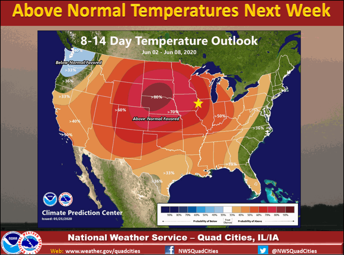
Drier air has taken over and it feels pretty nice outside. Now the sun is strong this time of year and it still feels pretty warm but by the numbers it is dry. Dew points (the humidity) Saturday evening were in the 30s and 40s across the Upper Midwest. That is dry air - especially this time of year. Especially feels nice when just a few days prior we were dealing with dew points in the 60s and 70s. This dry air will continue into Sunday... Then, in the upper levels, a big rid

A CHANGE IN THE WEATHER...
It was hard not to notice the change in the weather around the central Midwest Friday. A cold front which passed by daybreak was followed by much cooler and drier air. The rain which had been an occasional feature all weak long was finally no longer a player aside from a few spotty showers and sprinkles in Wisconsin. On the satellite you can see the leading edge of the cooler air marked by clouds and the cold front from Michigan into Indiana. Late day temperatures were stuck

IT'S A WRAP FOR THE RAIN AND WARMTH...FOR NOW!
Last night I showed you some data on how wet May has been east of the Mississippi in my area. Northeast Illinois has really been soaked as evidenced by the fact Chicago (now with 9.30") has set its all-time total rainfall record for the month. As soggy as that is it pales in comparison to the wettest month ever which was 17.10" in August of 1987. Here's the all-time monthly records for all months in the Quad Cities and Cedar Rapids. Quad Cities (Moline Airport) Cedar Rapids F

WHAT GOES UP, MUST GO DOWN...
Despite the rain that's fallen the past couple of weeks, May is running near to slightly below normal in terms of precipitation over eastern Iowa. East of the Mississippi in Illinois, its a different story where most spots are 1 to 5 inches above normal, far too wet for many farmers. These are the mean departures over the past 30 days. Here's a specific look at May rainfall totals. The area around Chicago has been drenched by 6-9 inch amounts. Another look at specific departu

A TURN IN THE ROAD AHEAD FRIDAY...
Tuesday was another warm summery day featuring scattered thunderstorms. A tornado watch was even issued for my western counties. Tornado reports were confined to brief small spin ups with no apparent damage. There were a number of thunderstorm warnings but in most instances little more than gusty winds (downbursts) and brief gully washers occurred. Here is what the Storm Prediction Center shows for reports. Rainfall was spirally banded as you can see in the Doppler estimates