


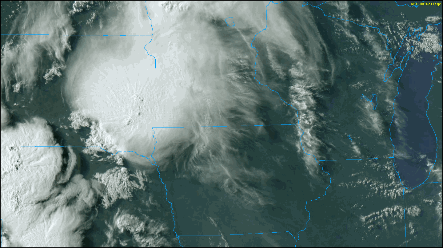
FRIDAY'S STORMS TIED TO OUTFLOW BOUNDARIES...
The satellite image below was taken late Thursday evening. The obvious feature of interest is the thunderstorm cluster that's formed...
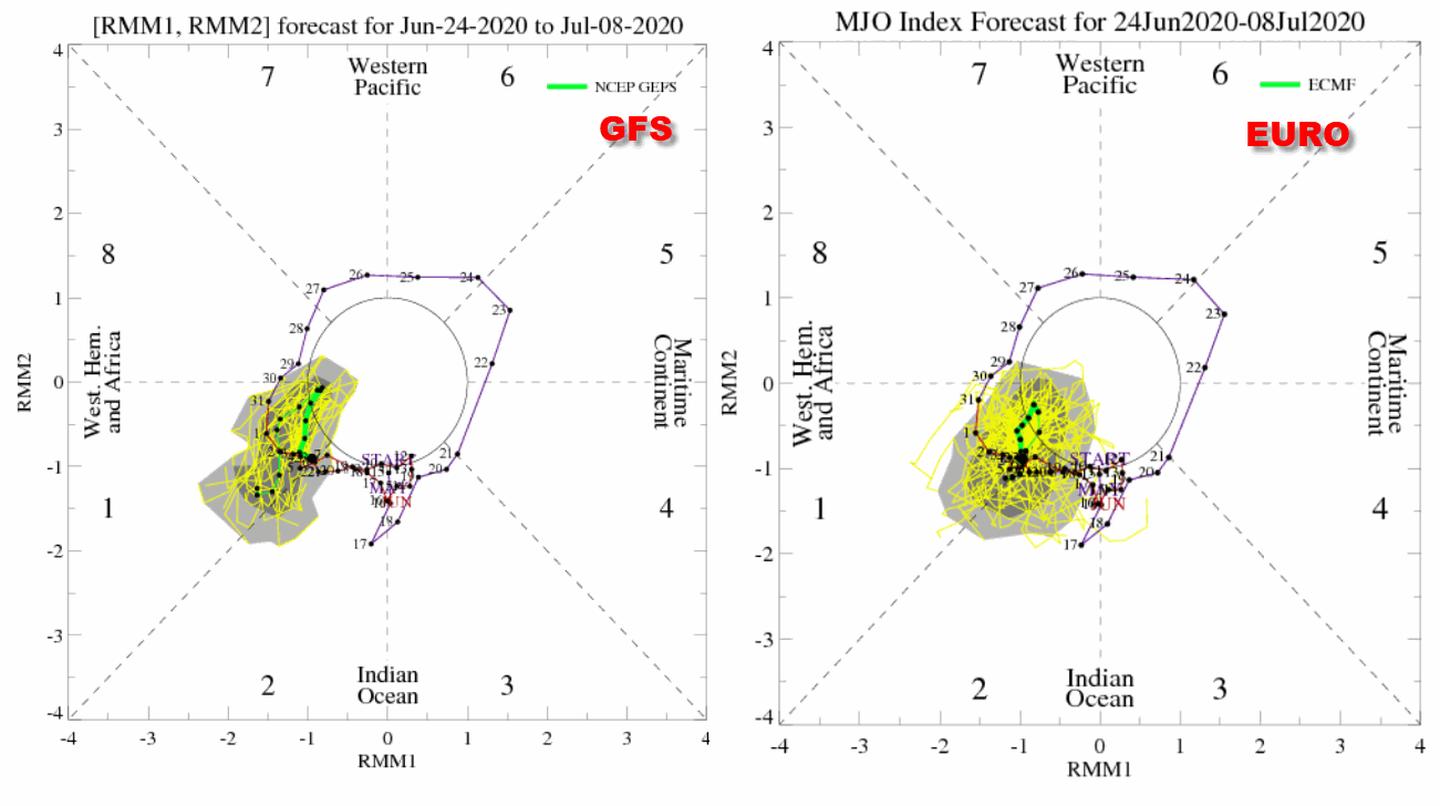
LEADING THE WAY TO WETNESS...
The Madden Julien Oscillation (MJO) has done a very good job of depicting potential periods of wet weather around the central Midwest the...
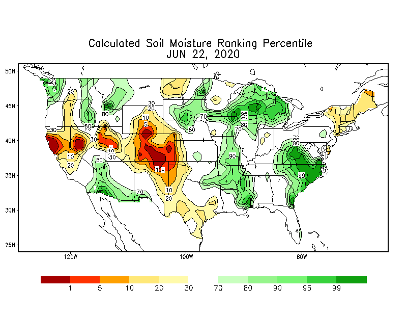
THE FUTURE HAS THE POTENTIAL TO BE SOGGY...
The weather improved around the central Midwest Tuesday but as expected there were still a few scattered instability showers and storms....

WHEN IT RAINS, IT REALLY POURS...
We told you last week we were going to get back into a wet and active period. It turns out the forecast was correct but in an understated...

MORE STORMS MONDAY....
Thunderstorms rolled through the area during the day Saturday. Some storms were strong and produced hail and gusty winds. Now more storms...

