A WINTER STORM, WHAT'S THAT?...
- Jan 24, 2017
- 3 min read

With a winter storm knocking on the door of the Midwest it was nice to see the first images of the hi-resolution GOES 16 Satellite. It was launched in November and it took until today to see the first pictures. These are only test images as the satellite will not be operational until November of 2017. However, I like what I see so far.
In the image below you can glimpse the low pressure and cloud deck that will influence the weather around the central United States the next few days.

Below you can see the winter storm advisories in effect as of late Monday. Warnings are in pink.

As with all winter storms the track is always critical as to who gets what. For the most part, there are minimal changes from what we saw yesterday. The GFS and its counterparts are further NW and the EURO is the outlier further SE. That does cause precip. type issues for my central counties but in general there’s agreement the storm heads for EC or SE Iowa, a favored track all winter long. Here’s what the latest GFS shows at midnight Tuesday.

It’s track means most of the significant snow falls northwest of my forecast area. If it and the rest of the U.S. models are correct, the heaviest amounts of 3-8″ falls northwest of a line from Omaha, to Ames, to Waterloo, McGregor, and just north of Madison (near Portage, Wisconsin). The EURO is further southeast by at least 75 miles and I will get to that important distinction in a minute.
No matter what model you buy something else to watch for in the snow band is cold sector convection (thundersnow)! Lapse rates on some of the models are hinting at that potential which could up amounts in local spots.
OK, here’s the snowfall forecasts from Monday night’s U.S. model runs. Excellent agreement in this family but are the solutions correct?
THE GFS:

The hi-res WRF

The NAM:

In contrast hat takes us to the EURO and the fly it inserts in the ointment. Here’s its surface depiction. The position of that surface low NW of Burlington, Iowa Wednesday morning is problematic.

The more southerly solution gets that snow band further southeast into more of my forecast area. For example, Dubuque goes from less than and inch (.9″) on the GFS to 6.0″ on the EURO. The cut-off to the heavy snow goes from just north of HWY 20 to about HWY 30. The heavy snow band on the EURO of 3-8″ goes from south of Des Moines to just north of Cedar Rapids to the southeast tip of Wisconsin.

In all honesty, its impossible to thread that needle so all I can say is if you are in my area, especially near or north of HWY 30 keep and eye on the trends the next 12-18 hours. The significant snow band is still being defined. This is going to come right down to the nut and short term trends.
For kicks the Weather Prediction Center is showing these odds of at least 2″ of snow over a 72 hour period.

The WPC also has these odds of at least 4″ of snow over 72 hours time.

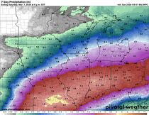
The rain that falls in the warm sector is expected to be light to moderate. The GFS has this for total QPF.

Last but not least, where the rain falls it will change to snow showers before it ends. That means most areas outside of the heavier snow band will see snowflakes before the system departs. Maybe some minor accumulations. Along with the snow showers will come much colder temperatures. The GFS has this for highs Friday. Back in the low to mid 20s!

That’s what I have for you. Now its time to sit back , fine tune, and watch it all happen. For my snow brothers and sisters who do get the snow, enjoy the white gold for me! Roll weather…TS


Appreciate this bllog post