


ACTIVE PATTERN CONTINUES...
Rain will be fairly light through the Upper Midwest this weekend, but many areas picked up beneficial rainfall. Here's the rainfall through Saturday:

Here's a zoomed in version with some of the higher amounts in Missouri and Illinois:

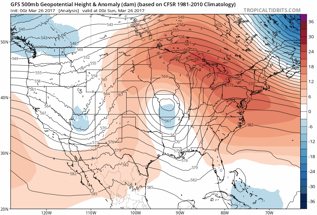
The pattern stays active through the next two weeks across the central United States. There are some differences in the models as to where these storms will track. But check out the latest GFS - a lot of energy in the pattern.
In the short term, the set up will bring the threat of severe weather to parts of the southern and central plains. Here's the outlooks from the SPC over the next 5 days:

Severe weather has already gotten off to a roaring start across the U.S. With incredibly warm water in the Gulf of Mexico, it should be an interesting spring and summer. There has been some work being done lately by the National Severe Storms Laboratory to improve severe weather warnings. Here's a video explaining the work:
Forecasting a Continuum of Environmental Threats or FACETs hopes to improve watches and warnings and improve how the threat is communicated. The hope is for longer lead time for areas threatened by severe storms, tornadoes in particular. FACETs also aims to become more precise and reduce false alarms. One new tool helping in making these changes in the new satellite, GOES 16. The data is not operational yet but it is beautiful.
GOES 16 should be in full use within a year and it will also take some time before any changes come to the new warning system. Some exciting advances coming to the weather world!
RK


