


IT'S "SNOW" JOKE, WHAT A PATTERN...!
- Apr 24, 2017
- 3 min read

Monday was a windy, warm, and dry day around the central Midwest. Much of my local area saw relative humidity levels around 15-20 percent for much of the afternoon. Here's a look at some 6pm readings. The 16% levels in Waterloo and Dubuque are not much higher than the 9% measured in Phoenix.

With the dry air in place, the addition of sunshine and brisk south winds sent highs into the low to mid 70s over most of my region. Readings are still in the low 70s all the way to SW Wisconsin at 7pm in the evening.

There's one more warm day in the bag and then a radical change in the long wave pattern will drop temperatures and produce a prolonged period of cold, wet weather. Look at the 500mb jet stream pattern today and what it's forecast to look like this weekend.


Not only does this type of flow bring cold air, it also promotes a strong moisture transport from the Gulf. Look at the PWAT's (precipitable water vapor) today compared to what's coming Wednesday. Water vapor levels go from .04" in SE Iowa to 2.00" Wednesday morning. Bye bye 16% humidity!


On this GOES 16 water vapor loop you can see a chain of energy that runs across the Pacific and into the SW U.S. That is very impressive!.

Within the energetic flow, 2 storms will impact the Midwest over the next 7 days (one Tuesday night/Wednesday, the other Friday-Sunday). Rainfall is expected to be significant in many parts of the Midwest. The GFS has this for total rain through noon of next Monday.

The EURO has this for the same time period.

Now, here's where things get juicy and fun. Both the GFS and the EURO show a deepening surface low traveling from Missouri to northern Michigan Sunday-Monday. Both models change the rain to snow in spots and both show wet accumulations. Here's the GFS surface depiction Monday morning. That blue is snow from parts of Iowa into SE Minnesota and Wisconsin.

Normally I would laugh at the GFS 6 days out, especially May 1st. However, the EURO is showing a similar development at the exact same time. Take a look.
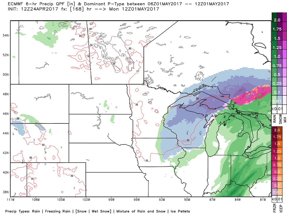
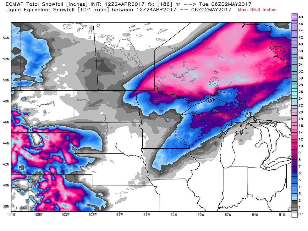
At least for now, this is what the two best models we have are showing for accumulations. First the GFS and then the EURO. I doubt my area will see much (if any) but NW Iowa, parts of Minnesota and NW Wisconsin have a real shot!

Just to emphasize, I am not calling for any snow in my area. I'm just pointing out a trend that may or may not hold in the upper MIdwest. And even if the trend holds, the position and amounts will change in coming days. No need to get your knickers in a bunch.
However, I have to tell you snow May 1st is not unheard of. It's very difficult to pull off and everything has to come together just right to form what I would call a perfect storm. The last time I recall it happening was May 1-3 of 2013 when record snows coated my western counties. Just look at these amounts in Iowa.

Here's a larger perspective of the same system. Even NW Arkansas saw a couple inches!

Of course, even if it snows (and that is a big if) it will be gone in a flash. That's the beauty of snow in late spring. No matter what happens, it's going to be a lousy stretch of weather once things start going downhill midweek. I'll keep and eye on it going forward. Roll weather...TS


Comments