


HARVEY, BILLION DOLLAR BABY...
- Aug 24, 2017
- 2 min read
A lot can change in 24 hours and that's certainly been the case with hurricane Harvey. Yesterday the storm was projected to come ashore in SE Texas as a strong tropical storm or a minimal category 1 hurricane. However, the storm has rapidly intensified thanks to weak shear aloft and the 90 degree waters of the Gulf of Mexico. You can see where the warmest water resides below.

Here's the upper level shear. Strong winds aloft can disrupt the circulation and keep the storm from intensifying. That is not the case with Harvey as you can see below. The green regions are favorable for tropical cyclone intensification

By late Friday many models are now showing Harvey as a strong category 2 or 3 storm. Here's what the various models were predicting as of Thursday evening.

The National Hurricane Center calls for a major hurricane at landfall with 120-125 mph sustained winds. Landfall should be close to Corpus Christi, Texas late Friday night.

Here's where the greatest threat of tropical storm force winds are currently focused.

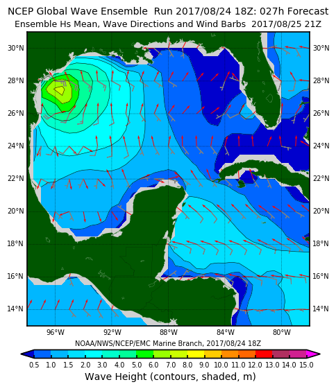
Along with the winds will come a significant storm surge. Waves up to 8 feet on top of high tides are anticipated.
Without a doubt the biggest issue with the hurricane will be the epic rains models are forecasting. The storms intensity and slow movement will generate widespread excessive rains of 10-20 inches on the southeast Texas coast. Some models are indicating the potential for more than 35 inches. The Weather Prediction Center is forecasting this for general rain totals. There will be spots with much more.

Should the situation unfold as expected, devastating and deadly flooding will be the by-product of the storm. The potential exists for a billion dollar disaster in the state of Texas! Friday will be a tell tale day as Harvey decides who to punish and for how long over the Lone Star State. Roll weather...TS


Comments