


HISTORIC IRMA CONTINUES TO BATTER FLORIDA...
Hurricane Irma made two landfalls in the state of Florida on Sunday - one on Cudjoe Key (in the Florida Keys, as a category 4 hurricane) and another on Marco Island (as a category 3).
This is the first major hurricane to make landfall in Florida in 12 years, since Wilma in 2005.
This is the first time on record two category 4+ hurricanes have made landfall in the U.S. in the same year.
This is the same date Hurricane Donna, also a category 4, made landfall in the Floriday Keys - back on September 10th, 1960.
In another way that history repeats itself - Irma's second landfall on Marco Island was where Hurricane Wilma made landfall back in 05.
In Miami, about 130 miles AWAY from the center of the storm, 100 mph wind gusts were reported and storm surge flooded the streets.
In Naples, in the northern part of the eye wall, a 142 mph wind gust was reported with 95 mph sustained winds.
Several tornadoes have been reported across the state.
Widespread power outages in Florida right now and restoring all of the power may take weeks. More power outages are likely in parts of the southeast.
Irma will continue to interact with land and weaken as a result. However, wind damage and flooding from storm surge still going to be an issue into Monday up and down both coasts of Florida. Irma will then continue northward and bring heavy rain and high winds to portions of Georgia, Alabama and South Carolina.
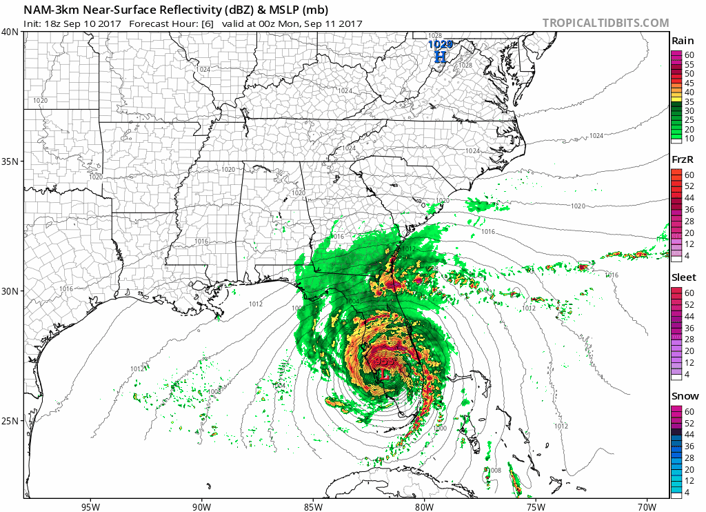
Above is a high resolution model solution through Tuesday morning. There are going to be some wobbles the storm will take that the models can't resolve but this is a good simulation of the high wind and rain. Here's a look at the rainfall expected now through Tuesday:

Rainfall totals around 3 to 7 inches will be common from Irma. Some localized totals around 12-14 inches will be possible. We will not see large totals, like we did with Hurricane Harvey, but the storm surge combined with this rain will lead to some flooding.
Meanwhile in the Midwest it's the same story, different day. Temperatures have moderated closer to normal, but it's still calm and dry. Rainfall through the next seven days:

Not much to be seen around here. Rain will be possible in the northern parts of the Midwest. Drought stricken areas won't be getting much though.
RK


