DESPITE COMING THAWS, WE'RE NOT DONE WITH THE ARCTIC....
- terryswails1
- Jan 9, 2018
- 3 min read
Back in mid December I posted about how the MJO (Madden Julian Oscillation) was projected to enter and travel through the holy grail of cold phases 7, 8, 1, just before Christmas into early Janaury. Here's a segment of my blog written December 20th alluding to the MJO and the cold that was coming. Did it ever!
The Madden Julian Oscillation (MJO) has now reached phase 7. That's a key benchmark as it means the Midwest is entering a prolonged period where the MJO will remain in cold phases that correlate strongly to below normal temperatures. In fact, this is likely to last much of the next 15 to perhaps 20 days once the cold kicks in this weekend.

If you follow the dotted green lines you can see the MJO's path through 7, 8, and 1 between now and January 1st. To the right you can see the corresponding temperature anomalies for each phase.
I looked at the CFSv2 mean temperature departures the next 15 days and it agrees much of the nation and Canada will be consumed by the chill. The Midwest is right in the thick of it.

All the models agree some of the most intense and widespread cold will be in the period December 25th-30th. Look at these departures. T. Swails.....

On to the present. The reason I bring this up is because before the MJO really made its push to deliver the cold, the stratosphere was already giving us an even earlier hint that Arctic air was coming by signaling what's called a strat-warming.

In the layer of our atmosphere known as the stratosphere (roughly 30 miles up, or 30mb), temperatures instead of remaining cold, were actually getting warmer. The warming was projected to reach its peak in late December. Here's what the GEFS was forecasting December 12th for anomalies December 28th. Dramatic stratospheric warmth in the western and central Arctic.

When temperatures warm aloft in this layer of the Arctic, it can stretch or even split the polar vortex. In essence it displaces the cold that would otherwise reside there forcing it to the surface and then southward into the upper Midwest. (There's a 10-14 day lag period before the cold arrives down here). If you see the stratosphere warming in the Arctic, it goes to figure the MJO would also enter cold phases by the peak.
Recently, the stratospheric warming has reversed and been replaced with cooling. The net result will be a warmer brand of weather mid to late January over the upper Midwest. Take a look at today's stratospheric temperatures. There's a clear difference from what we showed above.

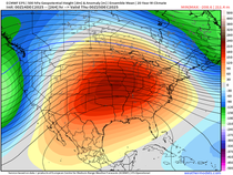
The milder weather exposes itself in the day 10-20 period with temperature departures like this January 19-29.

I'm going somewhere with this and here is the kicker. The stratosphere is now forecast to warm again in the next 15 days. The GEFS shows a temperature forecast that looks like this January 25th. That should look familiar. While it's not as dramatic (at least not yet) it's not far from what we were looking at back on December 12th and we all know what came after that.

The MJO is expected to be in the warmer phases of 4, 5, and 6 much of the next two weeks. That makes sense since there is currently cooling in the Arctic stratosphere. However, when that cooling flips to warming in the next 10 days look for the MJO to cycle back through the cold phases we are just coming out of. Already the GEFS MJO is trending in that direction. Follow the dotted green lines toward phase 7.

The CFSv2 is sensing the return of the cold by forecasting these February temperature departures.

This session was a lot to swallow but its fascinating to me how weather and the atmosphere is all one big puzzle. Put the pieces together and it all makes sense. Hope you learned something. Roll weather...TS


Comments