NOT SO SPRINGLIKE START TO SPRING...
- rebeccakopelman
- Mar 18, 2018
- 1 min read
Astronomical spring begins this week, but it's not going to feel like it. Once the fog and clouds cleared it was a nice day across much of the Upper Midwest Sunday. Monday will be similar with sunshine and temperatures running above normal...

To the south of Iowa and right through Missouri a storm will be moving through and will lead to strong to severe storms in the southeastern U.S. At 500 mb the low closes off and will be quite strong.

There will be plenty of instability and wind shear which will lead to the potential for strong winds and tornadoes Monday and Tuesday. Here's the outlook for the Storm Prediction Center for Monday -

And Tuesday -

Signs of spring to the south... while in our neck of the woods temperatures will fall once again. Tuesday afternoon's high temperatures will be back below normal -

Additionally on the back side of the storm there will be the potential for some light snow in the Dakotas, Minnesota and Iowa on Tuesday -

Accumulation will be pretty light and of course in March will not stick around very long. Here's the projected accumulation on the GFS, NAM, and European -


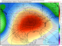
And the pattern remains pretty cool with temperatures near and below normal through the week. Spring begins Tuesday, but it's not a switch... but spring will come eventually!
RK


Comments