


AND ANOTHER ONE....
Winter just keeps hanging on in the Midwest. Monday afternoon temperatures were running 10 to 20 degrees below normal with snow on the ground and blustery northwest winds.

Now Tuesday will be the calm before the storm... as another storm moves into the Midwest midweek.

A storm is taking shape out in the western United States and will be strengthening as it moves east.
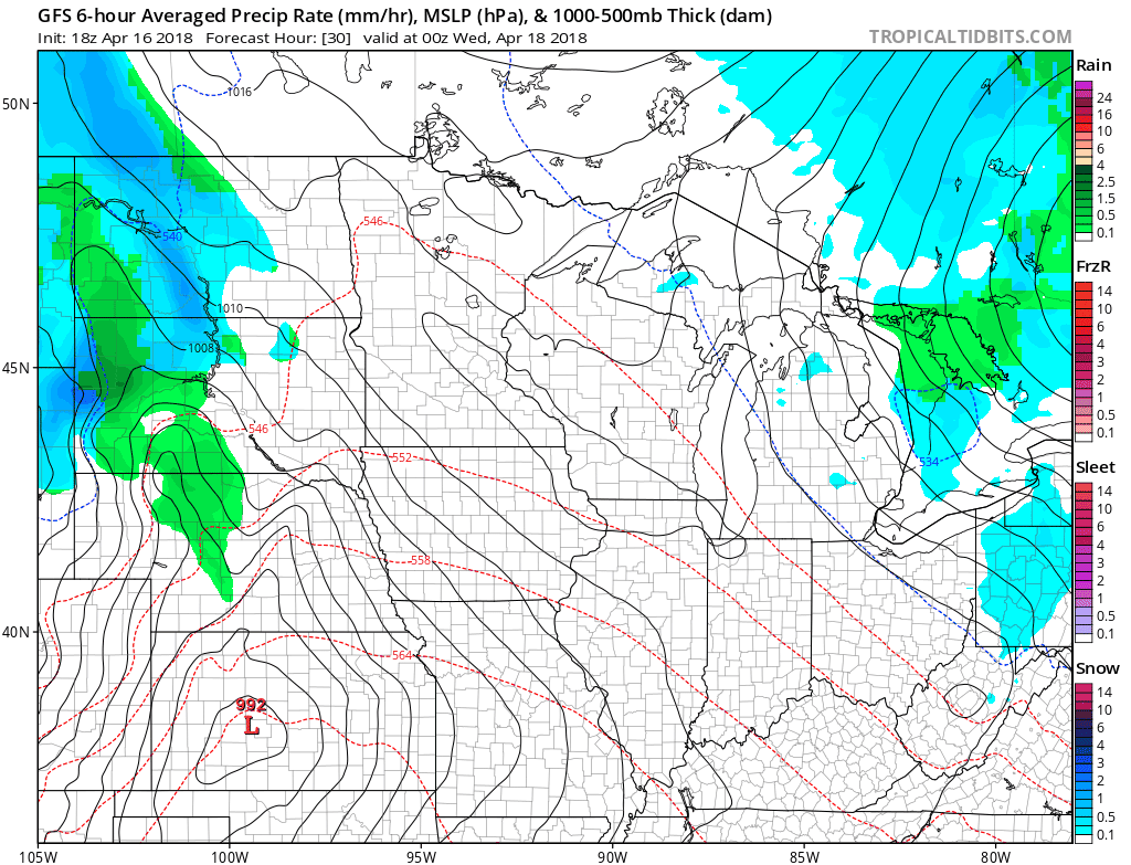
The surface low isn't particularly strong, but it does have upper level support. A closed 500 mb low - showing the strength of the cold air - pretty impressive!

There are still some differences as to where the heaviest snow will fall with this storm. There's some disagreement on the amounts and the placement of the heavies snow. First the GFS, which paints the heaviest snow in southern Minnesota and norther Iowa:

The Euro, which has a southwest to northeast band in northwest Iowa. It also takes the snow to I-80:

And the NAM, which has overall lower snowfall totals and takes the snow to Highway 30.

It looks like northern Iowa and southern Minnesota are once again in line for the heavier snow. That is where Winter Storm Watches have already been issued -

There will hopefully be more agreement among the models with the 0z run of the European and especially this afternoon.
Bottom line is... winter isn't done with us yet! RK


