


FAIRLY "QUIET" END TO MAY...
- May 20, 2018
- 1 min read
We have talked about how it has been a pretty quiet severe weather season. We are in the most active time of year - climatologically speaking - but it certainly doesn't seem like it. In fact the Storm Prediction Center put this in their long range outlook "Uncharacteristically weak flow regime, for mid May, is expected to persist this week across most of the CONUS. As a result, severe predictability will necessarily be low during the day 4-8 time frame."
Now this doesn't mean it is going to be dry or that there will not be any severe weather, but the pattern just isn't very progressive.

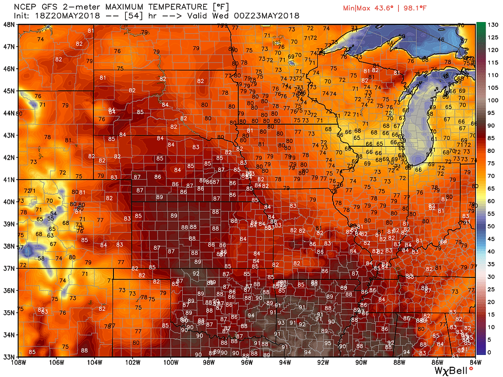
This has been the dominate pattern - a big 'ol ridge sitting over the United States. This leads to weak flow from the Gulf of Mexico and basically blocks any storms from progressing east. This will also result in warm, above normal temperatures once again this week.

There will be showers and thunderstorms ongoing early Monday in parts of the Midwest which will result in temperatures being held down in spots.

It will be warmer Tuesday and the rest of the week with temperatures in the 70s and 80s.
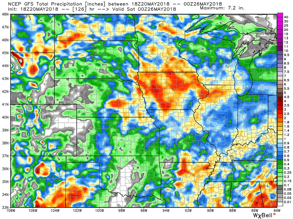
There will be a few systems that move through the area, but the severe weather risk in the Midwest looks to be low until the end of the week. Seven day totals look like this on the GFS -
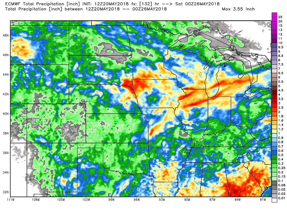
And Euro -
We'll talk day by day as these systems unfold and we'll have a better understanding of the placement and strength of the storms.
RK


Comments