HOT IN THE LAND OF ENCHANTMENT, STORMS BACK HOME...!
- terryswails1
- Jun 25, 2018
- 1 min read
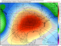
Today is the first day of my American Meteorological Society convention here in New Mexico. With all that's going on and the fact my family is with me, it's going to be tough for me to keep up on the weather back home. Short on time if you know what I mean!
That said, I did want to make a mention that strong storms, heavy rain and perhaps severe weather will pay a visit to the Midwest later Monday and into Tuesday. The culprit is a low pressure that slowly crosses Iowa in the next 48 hours. Storms will fire in western Iowa today, reach my area tonight and them refire at some point late Tuesday and Tuesday night. You can see the low in Iowa and the storms ahead of it Tuesday at 7:00.

While instability is questionable Tuesday due to debris clouds and the amount of available sunshine, it does appear CAPE will be sufficient for some strong storm updrafts and supercells. All modes of severe weather are possible, especially of decent heating can be attained. Here's the forecast CAPE on the EURO.

The Storm Prediction Center has this for severe weather risks Monday and Tuesday.


The EURO has this for rainfall. Heavier amounts are likely where stronger storms develop.

Well, time for my first conference session. Stay well my friends. With affection from New Mexico, roll weather ...TS


Comments