VARIETY, THE SPICE OF WEATHER....
- Jul 24, 2018
- 1 min read
If there's one thing Midwest weather is known for it's variety. In this case, you can see it in this year's rainfall. Notice the range in amounts the past 180 days centered on Iowa. Totals as low as 16" in SC Iowa and as much as 34" in the NW part of the state.

For the most part, the northern 2/3rds of the state has seen above normal totals while the south remains dry. Here's the deviations from normal.

A larger perspective of Midwest rain over the past 180 days. The Ohio and Tennessee valley's have been exceptionally wet. Severe drought exists from NE Kansas into NW Missouri.

Midwest deviations from norm.

The latest drought index reflects extreme drought conditions in NW Missouri.

Looking at the next 10 days, the Euro indicates the rich get richer with the heaviest rains falling where they've been occuring the past 180 days.

Here's a closer look centered on Iowa.

Again, the reason for the lack of precipitation in my area will be the NW flow aloft that limits moisture and instability for heavy showers and storms. The 500mb pattern you see below is quite unusual for late July/early August. It impedes deep moisture from entering the Midwest.

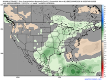
Not only is it dry, it's anomalously cool. This is the GFS temperature departure over the next 5 days. The real cooling won't be felt until Thursday.

By the way, if you are wondering where the heat is, look no further than the southwest. Death Valley set a record high Tuesday with a sizzling 127 degrees. Phoenix ended up at 116.

That's a wrap for now. Enjoy the coming taste of September. Roll weather...TS


Comments