


YOU ASKED FOR IT....
- Aug 21, 2018
- 2 min read
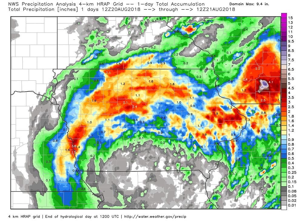
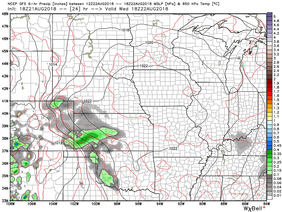
It's been on the menu for about a week and now the long advertised cool shot has made its way to the Midwest. This follows on the heels of the major storm system that soaked much of the region Monday. You can see the northern half of Iowa and southern Wisconsin racked up the largest rain totals in the 24 hour period ending at 7:00am Tuesday.
Here's a larger perspective. Note the amount of real estate that had rain from this expansive storm.
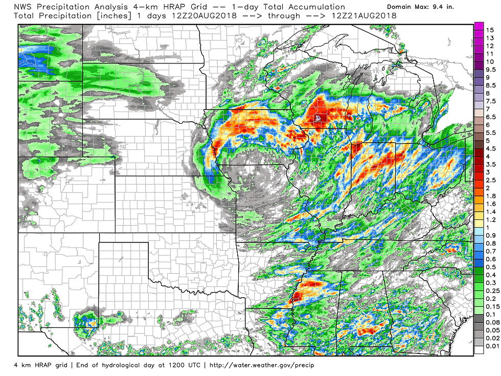
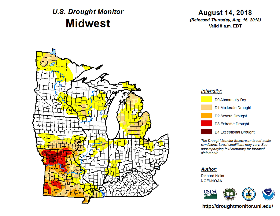
Unfortunately, much of southern Iowa and northern Missouri which remain in drought conditions came up short once again. Close but no cigar, very disappointing for that area.
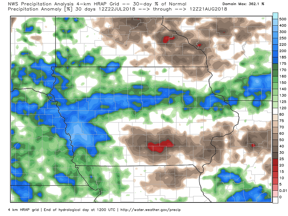
Here's the 30 day precipitation analysis. In the blue areas rainfall is up to 200% above normal. In the reds it's only 20% of normal in SC Iowa.
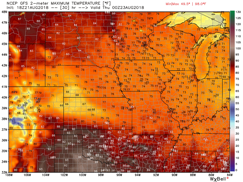
One thing that everybody will see the next 2 days is some wonderful August weather. High pressure will be perched directly over the Midwest ensuring fair skies, light winds, and comfortable temperatures.
We'll begin Wednesday nice and crisp. The hi-res 3K NAM-NEST has lots of 40s to start with from roughly HWY 30 north.

Later Wednesday, highs will warm to the 70s, more typical of mid-September. That's following a high of 73 in Cedar Rapids Tuesday...the coolest reading since 64 back on May 21st.
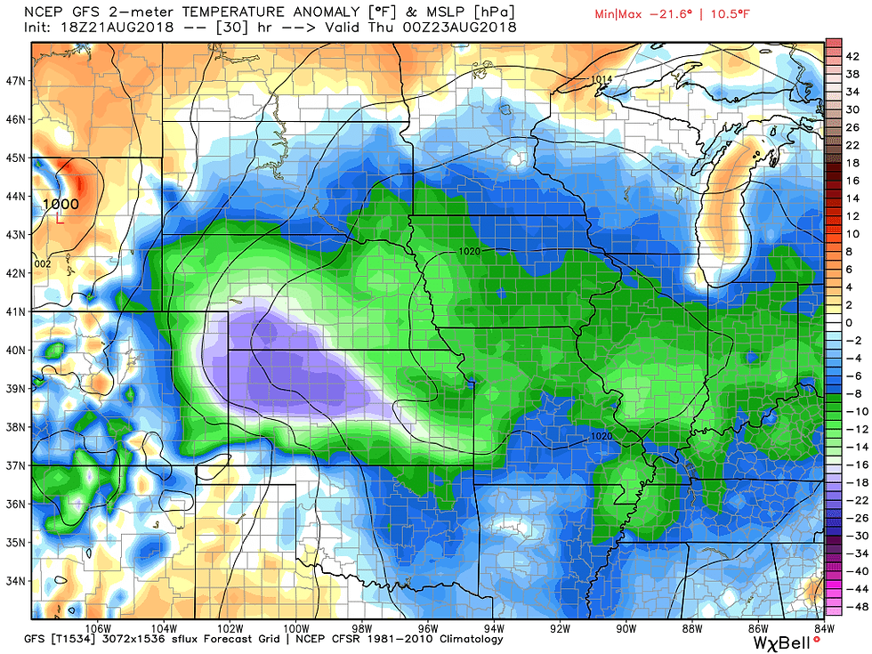
Here's the temperature departures showing how much of the Midwest will be below normal Wednesday. Most areas 6-12 degrees.
This influx of pleasant weather will last through Thursday and then heat and humidity takes aim on the Midwest this weekend. As the muggy air arrives our next round of thunderstorms is expected. If we get the instability many of the models are showing strong to severe storms are possible Thursday night and again Friday afternoon and evening. That's a situation we'll have a better handle on in coming days. Meantime, you asked for beautiful weather and we've delivered. Enjoy! Roll weather...TS


Comments