


A WRAP FOR THE RAIN!
For 40 days and 40 nights the rains have come fast and furious across the central Midwest. So far no arks necessary but the amounts keep adding up. Here's the 40 day rain totals for some major Midwest reporting stations.

The 40 day departures look like this. Soggy times in most of the central Midwest.

A closer view of 40 day Iowa totals.

The Iowa departures.

One area that's been hit exceptionally hard is SW Wisconsin. Here's some numbers from the NWS office in La Crosse that blew me away. In Just 10 days, the town of Elroy, Wisconsin has racked up an incredible 23.42" of rain. There have been numerous occasions where the entire year (365 days) has produced less rain than that!

The wild card in the forecast the next 48 hours is the track of tropical storm Gordon's remnants. If all goes according to plan, the majority of my local area will stay dry as the energy enters Missouri and cuts east into the Ohio Valley. Here's the general track projected by the Hurricane Center. I think it will end up further SE, closer to St. Louis.

The energy Wednesday night is just entering Arkansas.

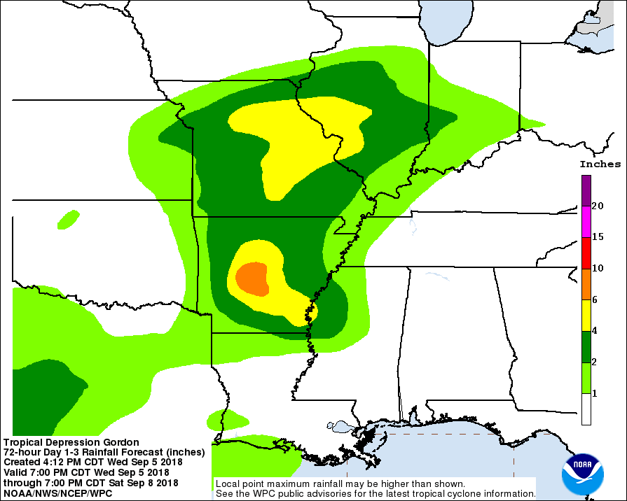
Below the official rainfall forecast from NOAA. Some of the rain just clips my southern counties but current indications keep the heavier amounts south of I-80. Great news for the swollen rivers and streams north of that point.
Before Gordon enters the scene, there is one more disturbance to deal with. However, most of the rain from it should fall south of I-80 where the threat of occasional rain will continue into Thursday night. Further north the drying trend is underway and will last through much of next week. The drier weather eventually sweeps across the remainder of my southern counties Friday as Gordan's remains head into central Illinois. By the weekend the entire central Midwest enters a pleasant September weather pattern featuring dry air and comfortable temperatures. A welcome reprieve is on its way. Roll weather...TS


