


IT'S A WRAP FOR SUMMER....
A powerful late summer cold front is abruptly changing the season around the Midwest. After highs in the low 90s Thursday (92 Cedar Rapids and 93 Quad Cities), Friday's readings will be at least 30 degrees colder. At 4:00pm Friday the 3k NAM shows 58 in Cedar Rapids, way down from the 92 degree reading just 24 hours earlier.

The cooling continues Friday night as winds decouple and skies clear. Scattered frost is possible by daybreak Saturday in the colder valleys of NE Iowa, Minnesota, and SW Wisconsin. The 3k has this for temperatures Saturday morning. Lots of places 50-55 degrees colder than Thursday afternoon.

After the chilly start Saturday morning, temperatures will warm into the 60s Saturday and near 70 Sunday. With abundant sunshine it will be a pleasantly cool weekend, more in line with what's typical for late September. Apple picking weather!
Overall the long range pattern continues to show a mean trough over the central U.S. into early October. This points to a continuation of cooler than normal weather the next 2 weeks. The Climate Prediction Center's 6-10 day outlook shows this for temperatures.

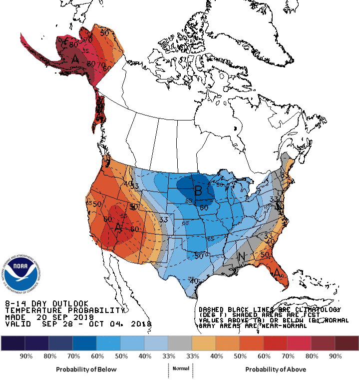
The cool air modifies a bit in the 10-14 period but is still pronounced.
Going a step further the EURO EPS weeklies out Thursday show the cool trend much of the next 46 days. The 51 ensemble members have this for average 46 day temperature departures ending November 4th.

This is the EPS Mean 46 day total snowfall. Pretty generous in the Rockies and much of Canada.

Precipitation is expected to remain near to above normal the next 46 days. Here's the EPS anomalies.

The actual forecast amounts through November 4th.

It's safe to say it's a wrap for summer. Balmy days like Thursday have left the building for many months to come. However, there will be plenty of fine fall days before the hammer of winter comes crashing down. Adios summer, nice knowing you. Have a great vacation and by all means roll weather...TS


