A CHILL IN THE AIR... FOR NOW
- rebeccakopelman
- Sep 29, 2018
- 2 min read
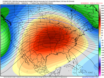
If you've been outside the last few days, well it feels as if we've entered fall. However, it's not here to stay just yet. It did get quite chilly Saturday morning though. Here are the low temperatures around my local area -

Afternoon temperatures just climbed into the 50s (15-20 degrees below normal for this time of year). These temperatures are more typical of late October to early November. So... of course it's not going to stick. Temperatures will be warming up as we get into next week and there will be some ups and downs..

With the temperature fluctuations comes precipitation of course. Terry has been mentioning another heavy rain threat and this is the latest from the Climate Prediction Center...

Above normal precipitation is likely across much of the country but we have a bullseye over the Upper Midwest through Iowa and parts of Wisconsin and Illinois. There will be multiple rounds of rain over the next 10 days. A boundary will be in overhead and multiple disturbances will move along it, leading to the heavy rain threat. This is the surface analysis for Sunday evening -

Another contributing factor to the heavy rain late next week will be due to Hurricane Rosa, which right now is in the Pacific Ocean. Rosa will likely be making landfall as a tropical storm Monday on the Baja California peninsula.

The remnants of Rosa will then move north and east into the central part of the country and bring tropical moisture along with it. This is a look at the precipitable water amounts (moisture in the atmosphere) for Thursday night into Friday.

To see two inch precipitable water mounts this far north in October is almost unheard of. These amounts are 200 to 300% above normal...

Here's the seven day rainfall totals from the GFS and European models -


The exact numbers and location of the heaviest rain will likely change. But a widespread area of heavy rain will be likely in parts of the Upper Midwest as we head into the month of October. This could mean bad news for area rivers as grounds are saturated and we've already seen many rivers rise twice in the last three weeks.
RK


Comments