


IT'S THAT TIME OF YEAR FOR YOU KNOW WHAT....
- Nov 2, 2018
- 2 min read
Numerous times on this site we've talked about the wet weather that's plagued the central Midwest since late summer. For some, the wet conditions have existed much of the year. Here are the precipitation departures for 2018 so far. The wettest conditions have been centered on northern Iowa and southern Wisconsin.

I came upon this graphic from the Iowa Mesonet showing the months of September and October as the all-time wettest in the Northeast Iowa Climate Division. Records go back to 1893. It's hard enough to break an all-time record for any month, let alone do it back to back. It's also interesting to note that 7 of the 12 monthly records have been set in the past 10 years. That does support the climate change theory of increased atmospheric water vapor in recent decades!

After a relatively quiet run of weather the past 3 weeks an increasingly energetic pattern will bring heavy precipitation back to the Midwest the next 7 days. You can see 3 anomalously deep troughs centered on the region that will drive the stormy weather.
Sunday:

Tuesday:

Next Friday:

Between the 3 systems, widespread precipitation totals of 1-3" are likely. The EURO has a 90-99% chance of at least an inch centered on my local area.

The odds are at 40-50% for 2.00"

The EURO shows this for 10 day total precipitation.

The GFS has this.

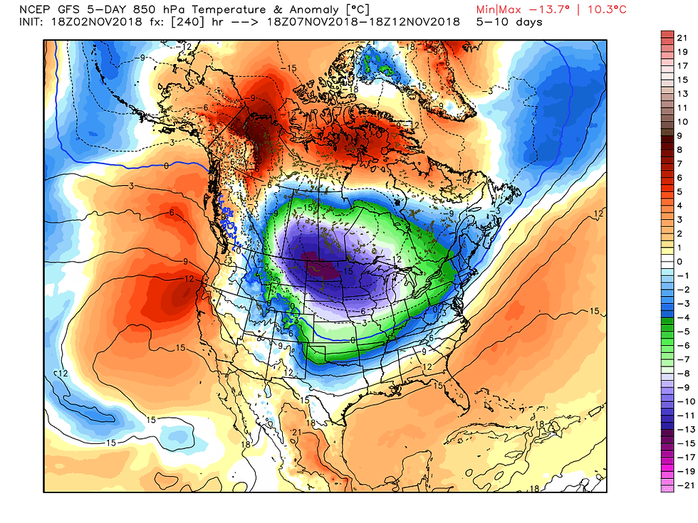
Both the EURO and GFS have a significant change to sharply colder temperatures that will reach winter-like levels by Wednesday of next week. Look at the day 5-10 temperature departures.
The GFS:
The EURO for the same period:

This got my attention. The operational EURO has lows next Sunday morning in the single digits. Wow!

If this were to happen it would produce temperatures 30-35 degrees below normal. Here's the anomalies.

The reason the model is so extremely cold is the fact that it shows a moderate intensity snow event for my area next Thursday or Friday. This is what the operational EURO has for totals.

A tighter view of amounts in my area.

The GFS is lighter and further south on the snow. That would keep low temperatures a good 10 degrees warmer than what the EURO is currently depicting next Sunday.

Just let me say this about the snow. We are very early in the game and nobody should put any stock in placement orf amounts just yet. What we're observing now is a trend and we'll need a couple more days of consistency before I get on the snow wagon. That said, there are some strong signals that cold and at least some snow is coming to the Midwest next week. It's that time of year. Roll weather...TS.


Comments