HOW DOES THIS WINTER RANK?
- Dec 9, 2018
- 2 min read
No doubt this has been an interesting (and early!) start to winter. Spring made a little comeback with the Illinois tornado out break on December first. But in general temperatures have been below normal and snowfall has been above normal - so far.
Here's the temperature departures for the month of December so far:

Temperatures have been near to around 5-6 degrees below normal during this first week. There hasn't been much snowfall in the Midwest this last week, but there was plenty of November. Here's the snowfall departure for the season so far:

Everyone is above normal for snowfall so far. Some parts of Kansas, Missouri, Iowa and Illinois have seen 500-700% of their normal snowfall.
So... how does the winter rank so far? Well, there's a way to figure that out! It's through the AWSSI - Accumulated Winter Season Severity Index.

The Midwest Regional Climate Center says:
The Accumulated Winter Season Index (AWSSI) was developed to objectively quantify and describe the relative severity of the winter season. The AWSSI is not limited to meteorological winter (December ‐ February) but is intended to capture winter weather from its earliest occurrence to its last. The winter season begins when the first of any one of the following instances occurs:
First measurable snowfall (>= 0.1 inch) • Maximum temperature at or below 32°F • December 1
The winter season ends at the last occurrence of any of the following: • Last measurable snowfall (>= 0.1 inch) • Last day with 1 inch of snow on the ground • Last day with a maximum temperature of 32°F or lower • February 28/29
Here's the rankings in the Midwest so far:

Now this isn't a perfect system, but it's a neat way to show the ranking of the winter so far. Much of the Midwest is in the severe (blue) or extreme (purple) category. Here's an example in Moline, in the extreme category:

The season is assigned points based off snowfall and temperatures and then placed in the categories above. Now check out the chart below, the red line represents last season's AWSSI and the black is the current season.

Last year much of my local area didn't see the first inch of snow until late December. The AWSSI in Moline last season barely even got into the severe category, let alone extreme. Just because we're starting off extreme doesn't mean we'll stay there.
In fact in the short term temperatures are going to be near and above normal. Here's the outlook from the CPC for December 16-22

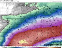
And the precipitation outlook:

We'll see how the rest of the winter season shakes out and what the AWSSI will be at the end of the season!
RK


Comments