


AN IMPRESSIVE WARM UP!
Temperatures shot up above freezing Saturday afternoon across the Midwest, despite several inches of snow on the ground.

The warm air was able to overcome this deep snowpack, where it is up to 15-18 inches in some spots! Here's a look at temperatures 3 pm Saturday:

What's also impressive is that temperatures went from all-time record lows in Cedar Rapids and Moline on Thursday morning to 70+ degrees higher just two days later! This was the warmest day for most of us in about three weeks.
The thaw and melting of the snow will continue though Monday. It will come with areas of dense fog and rain. Here's the temperatures for Sunday afternoon:

A storm will move through the Midwest Monday and will bring rain to Iowa and Illinois and snow to much of Minnesota and Wisconsin. Here's the storm Monday morning:

Temperatures will be mild ahead of the storm:

Between the mild temperatures and rain, there will be a pretty good loss to the snowpack. However, temperatures will start to drop behind the storm Monday afternoon and we'll topple down back below freezing by Tuesday morning:

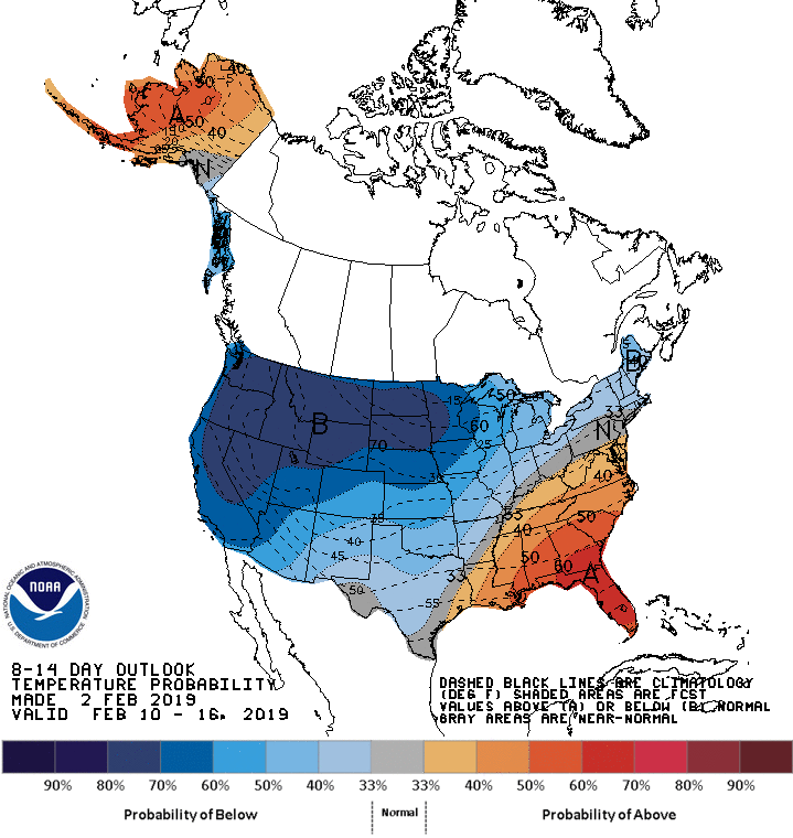
The thaw will be short lived as temperatures are expected to remain near and below freezing for the rest of the week. In fact the cold will likely last well into February, as Terry discussed in his last post. Here's the outlook from the Climate Prediction Center through February 16th:
It may be slushy and it may not be too pretty out there, but you'll want to enjoy the thaw while you can! Winter is not done with us yet...
RK


