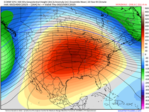
HOLD ON TO YOUR HAT, ENJOY THE WARMTH...
- terryswails1
- Mar 26, 2019
- 2 min read
Tuesday was the 146th straight day without a 60 degree high. Today is the day we end the streak. A strong south wind and a relatively dry air mass will combine to send highs into the 60s over much of my area. For many, the warmest highs since late October. Golf anyone?

The only knock on the day will be the strength of the winds. A tight pressure gradient will allow southerly gusts to reach up to 35 mph, maybe 40 in spots.

Here's the projected highs.

If you notice, readings in northern Minnesota and Wisconsin are held in the 30s and 40s. A large reason for that is plenty of snow that remains on the ground.

That snow also contains plenty of moisture which will be released when it finally melts...up to 8" in some locations.

For that reason, the longer the upper Midwest can stay dry the better it will be for rivers downstream, especially the Mississippi in my area.
Again, it looks like mother nature is going to play nice the next 10 days with the heaviest precipitation falling further south. The latest trends suggest the significant rains from the next system late this week will fall across the southern half of my area. Unfortunately models have been bouncing around on placement with the latest GFS showing this for amounts.

That's further north than the previous run below by at least 70 miles. We should get a better handle on the set-up later Wednesday.

Some models have also shown just enough cold air for some snow on the northern periphery of the precipitation shield. The only model that's really concerning is the NAM which is thermally colder and more intense with the system. It has this for snowfall Friday night early Saturday, really blasting my northern counties.

The GFS has this for amounts.

The GEM (Canadian) just came down and it has this for totals.

A degree or two and the position of the final track could make a huge difference in the eventual outcome, so for now it's the waiting game I'm playing. We'll see where things stand in later model runs. Until then, hold onto your hat and enjoy the warmer temperatures. Roll weather...TS


Comments