


HUNTING FOR AN 80...
- Apr 20, 2019
- 1 min read
Saturday was a beautiful day with low humidity, wall to wall sunshine, and mild temperatures. Check out the high temperatures across Iowa...

Sunday is going to be even warmer. Clouds will build through the day and winds will start to pick up out of the south. This is due to a cold front approaching from the north. That will be enough to send temperatures well into the 70s and near 80 degrees for Easter....

For many of us, this will be the warmest day of the year so far. For Cedar Rapids this will be the first 80 of the year and the first since October 3rd.
The same front that will be bringing the warmth will bring scattered showers and thunderstorms late Sunday night into Monday.

A half an inch to an inch of rain will be likely in my local area through Monday...
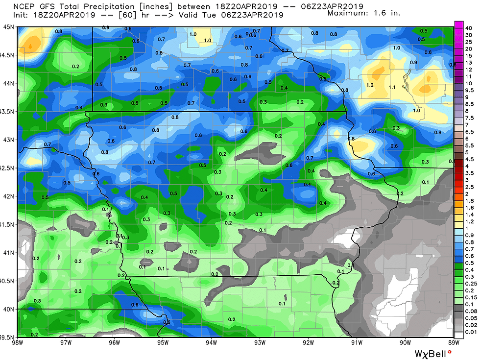
There could be some higher amounts in Minnesota and Wisconsin. Depending on where the heavy rain falls, there may be some additional rises on the Mississippi River. As the front moves through temperatures will be knocked back to start next week.
Monday's highs:
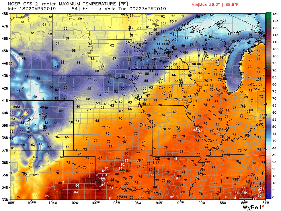
Tuesday's highs:

Temperatures will start to bounce back to near and above normal, in the 60s and 70s, for the rest of the week.
Hope everyone has a wonderful Easter!
RK


Comments