


SEARCHING FOR WARMTH....
It was another cool day Saturday. Caught by clouds and rain, temperatures were held down WELL below normal in the 50s. Sunday is, unfortunately, going to be much of the same.

The Upper Midwest sticks out like a sore thumb on May 12th... ouch. An upper level disturbance will be moving through and lead to another cloudy and cool day along with a few showers.

The good news is that there will be improvements after this weekend. In fact, check out the latest outlook from the Climate Prediction Center for the third week of May:
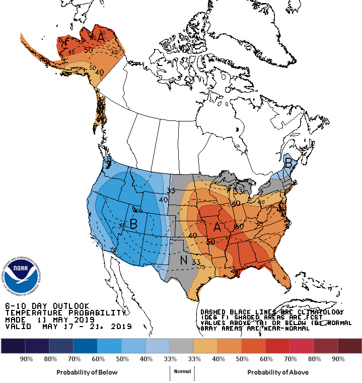
That's the first time I've seen an above normal outlook in weeks! Temperatures will be improving even as we head into next week.

Temperatures will be in the 60s Monday with sunshine, which will feel pretty nice. It gets a bit warmer Tuesday and there will be the chance for a few showers and storms Tuesday night into Wednesday.

And then temperatures will get into the 70s Wednesday...

The good news is the upcoming week will be warmer (than we've been) and drier! Here's a look at the 7-day precipitation totals for the next week:

Here's a zoomed in version -

This will bode well for the Mississippi and allow the river to continue to fall back down - which still has a long way to go, especially in the Quad Cities.

The Mississippi has spent a record 49 days in major flood sage and should fall below it Monday, but still has several feet to go before getting down below flood stage (15').
We're in a warmer and calmer pattern for now, but we'll see how long it holds...
RK


