


FALL WITH A SIDE OF STORMS...
This weekend felt more like October than August in the Upper Midwest. It will be a bit warmer and noticeably humid. Here's Monday's high temperatures:

Temperatures will be running around five to ten degrees warmer than Sunday. Dew points will be running five to ten degrees higher, too!

This will happen ahead of a cold front that will sweep through late Monday. There will be plenty of moisture for thunderstorms.... check out the precipitable water values (amount of moisture in the atmosphere):

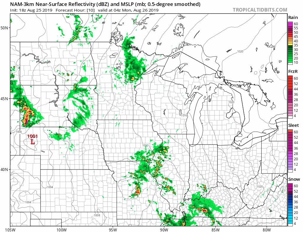
This will be a quick moving system so heavy rain won't be a huge concern, but any thunderstorms could put down a quick half an inch to inch of rain. There is a concern for strong to severe thunderstorms, however. Here's the Storm Prediction Center's outlook for Monday:

Strong winds and hail will be possible, especially in south of I-80. Tornadoes will be possible, especially in the "enhanced" area (in orange) in northern Missouri.
Here's a look at the hi-resolution NAM's projection of Monday's showers and storms -
Behind the rain we'll be back to the fall like feeling in the air with below normal temperatures and low humidity. That's going to be the majority of our weather as we head into the end of August and start of September...
Are you ready to switch over to fall? Ready or not....
RK


