


FROM FROST TO FALL...
It was a cold weekend and it's going to get capped off with frost on Monday morning. Temperatures will fall into the low to mid 30s and the conditions will be right for frost formation. Here's a look at the Frost Advisories around my local area:

Frost develops with temperatures in the 30s, clear skies, and light winds. The definition from the National Weather Service is as follows: Frost describes the formation of thin ice crystals on the ground or other surfaces in the form of scales, needles, feathers, or fans.
Here's a look at the low temperatures expected Monday morning:

It will feel a little nicer Monday afternoon under more sunshine. Temperatures, however, will still be below normal:

Temperatures will remain below normal through the end of the week. Here's a look at the temperature departures Tuesday through Friday of this week -

You can see a distinct change happen at the end... that's our flip back to "fall" and even above normal temperatures! That happens by the end of the week as an upper level ridge builds into the central U.S.

That will send temperatures back to normal for a few days, at least. Check out the 10 day temperature forecasts for Cedar Rapids and the Quad Cities -


Unfortunately with the return of "warmer" air will come the return of a more active pattern. The Climate Prediction Center is showing the potential for above normal precipitation as we head into the middle to end of October -
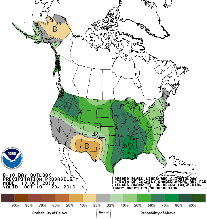
A lot of the Midwest does not need any more rain so we'll have to watch this pattern closely. It will become more clear as we get closer to it.
For now you'll probably still need the furnace for a few days and some people will need to scrape as frost will be possible Monday and Thursday mornings.
RK


