


THE FLAKES ARE FLYING....
Snow will continue to fall Sunday night through Monday. Winter Weather Advisories are in effect and fluffy snow will quickly accumulate. Roads will get snow covered as surface temperatures are at or below the freezing mark.


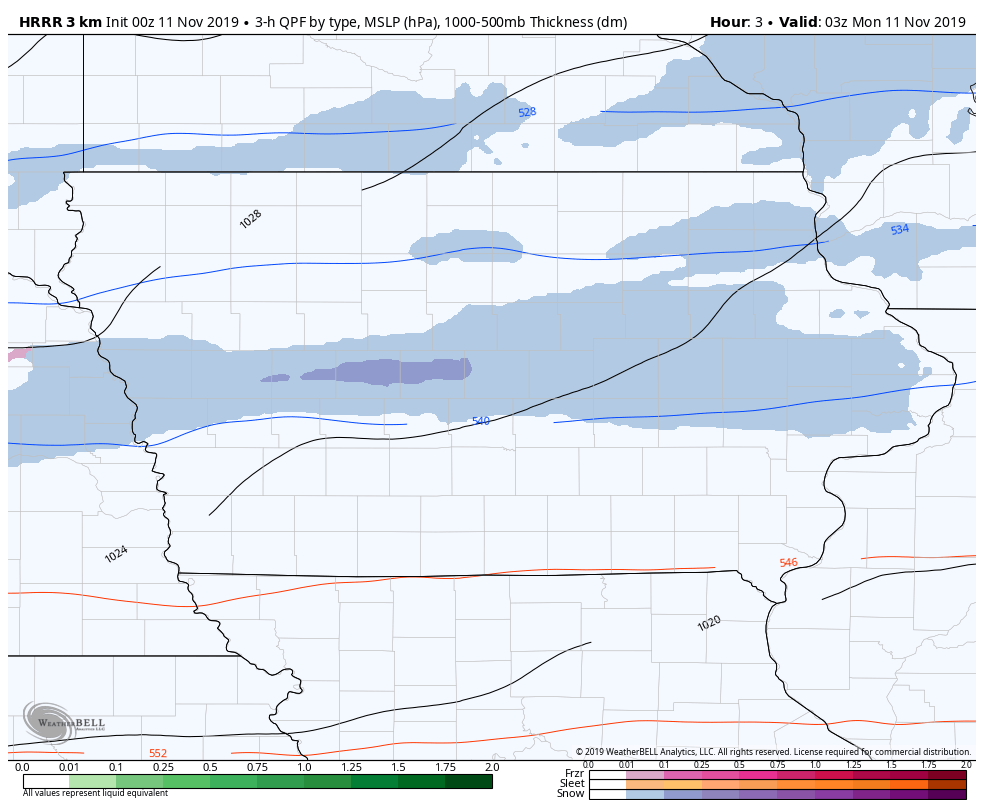
Here's a look at the hi-resolution rapid refresh (HRRR) model showing the snow fall...
There will be an fairly big area of moderate snow where there will be the possibility of upward of six inches of snow. This is in the wake of an arctic cold front so temperatures aloft (way above our heads) are well below the freezing mark and surface temperatures will dropping through the 20s and teens. The result will be a fluffy snow tht will be easy to shovel, but also easily blown around.
So let's go through some of the latest data.
European model:

The GFS:

The hi-resolution NAM:

The HRRR:

There is still some uncertainty in terms of how far north snow will fall in Iowa. Otherwise what is likely is an area of three to six inches of snow south of Highway 20 to around I-80. There will be the potential for higher amounts in northern Illinois and southern Wisconsin.
Snow will wind down in Iowa around midday and in Illinois in the late afternoon. With the snow on the ground and arctic air in place temperatures will likely set record for November 11th. The areas you see circled are where record cold high temperatures may be set.

And then record lows Tuesday morning:

Get the shovels ready and be sure to bundle up!
RK


