


A DECEMBER WARM UP...
- rebeccakopelman
- Dec 1, 2019
- 1 min read

We've seen our shares of ups and downs over the last few months. December marks the beginning of 'meteorological winter' - the time period when we typically have the coldest temperatures (December through February). However, the start of December is going to be on the 'mild' side. This comes after the weekend storm that dropped snow across the Midwest. Here's the latest snowfall totals from that storm -
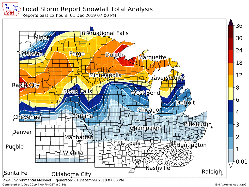
An impressive storm with over a foot in spots. And a very northern track for this time of year!
Now it will still be chilly Monday behind this system, but the Climate Prediction Center has above normal temperatures possible through the first half of the month.

Now, even though temperatures will be above normal it's still going to be cold. The 'normal' afternoon temperature in the Upper Midwest is in the mid to upper 30s.. The 'normal' nighttime temperature is in the teens to mid 20s. So even above normal won't be all that warm, but it's better than being below normal!
Here's a look at the long range forecast from the European model...
Cedar Rapids:

Quad Cities:

The month will also start fairly quiet, too. High pressure will move in behind this weekend's storm and we'll have several precipitation free and sunny days!
Here's a look at the pattern for the next six days (through Saturday):

The pattern may start to turn more active next weekend into the following week. The Climate Prediction Center concurs with that idea, adding in a slight chance for above normal precipitation during the second week of December...

We know the flakes will fly once again. Just a matter of when!
RK


Comments