


THE PARTY IS OVER FOR NOW...
CONSIDER THE VALUE PLEASE...TSwails.com continues to be a leader in catching and forecasting the trends of our extreme weather pattern the past few weeks. It takes a great deal of commitment, passion, and knowledge to stay on top of the swings. Now that I'm no longer in television, this is my job and that's the reason I'm asking for a voluntary subscription fee of $12 dollars a year, one dollar a month to keep TSwails going. Together we can create one of the best, most unique, and reliable weather sites in the Midwest. Your contribution of 3 cents a day, allows me to stay free of the corporate world and pour my energy into doing what I do best, forecasting the weather! We hope you see the value and hard work that goes into the site everyday. Your support in any way is sincerely appreciated. Thanks and roll weather. To donate click on the secure green box below.

MID-DAY UPDATE:
(AN UPDATE TO THE UPDATE)
In my previous post below I mentioned the chance of a quick burst of snow this afternoon in the northwest half of my area that could produce 1/2 to 1" of snow. As a result, winter weather advisories have been issued for some of my counties for the potential of some slick road conditions as the band passes. It will be short in duration, most likely less than an hour but intense snowfall rates for a short period will limit visibility and create a glaze on area roads.
Here are where the advisories will be in effect until 4:00.

This is the narrow band of snow that will cause the short disruption as it pivots northeast this afternoon. Again most of the impacts will be in the NW half of my area, especially EC and NE Iowa into SW Wisconsin. Extreme NW Illinois could also get clipped. Now you know...
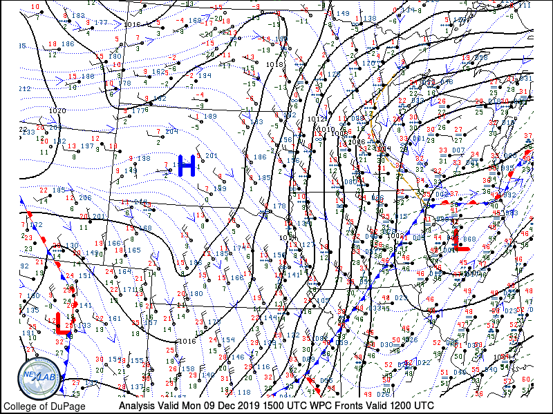
THE PREVIOUS UPDATE
The Arctic air that's been front and center is on the move and temperatures are getting set to decline. Northerly winds are also increasing in response to the strong pressure rises behind the front.
These are the temperatures around the nation showing the sharp contrast between the warmth and the coming cold.

A tighter perspective of the Midwest.

Notice the drop in readings over the past 24 hours. A good 25-30 degrees colder behind the front. That's what we get to enjoy on Tuesday.

Bottom line look for falling temperatures this afternoon and Tuesday readings like this are expected around noon.

These are the wind chills Tuesday morning...down around zero to 5 below here. Much colder to the north.

There is the chance of some light snow or flurries sweeping in behind the cold air this afternoon or evening. Little if any accumulation is expected in my area. Best chances for a quick burst less than an inch will be in the northwest half of region. However, it's again a different story further north where winter weather advisories are out for snow accumulations. The GFS shows this for totals through tonight.

Here is where travel will be likely impacted by the snow.

Wednesday a fast moving clipper cuts through the heart of my area. Moisture is limited and dynamics are weak but models are showing the potential for a narrow band of snow of 1/2 to perhaps 1 inch. The GFS has this band moving from NW to SE across the middle of my area late Tuesday night or early Wednesday. It won't be much more than a nuisance but we'll keep and eye on it. It will be a dry powdery snow where it falls.

That's where things stand at mid-day Monday. At least for now, the party is over for our balmy late fall conditions. Roll weather...TS
WEATHER SCHOOL IS COMING TO TOWN...
GIVE SANTA A BREAK! Christmas is less than a month away. Are you looking for something special for that hard to buy for person? Maybe you just want to treat yourself for being on the nice list! Well, here's an idea that can "give" any weather enthusiast a lifetime of pleasure. It's called WEATHER SCHOOL. What a person experiences and learns here will open up the world of forecasting for years of enjoyment to come. Consider giving the gift of weather. Better hurry, only 10 desks still open. You can get all the details below.

TSwails.com is offering a very special and unique opportunity to learn first-hand the ins and outs of weather forecasting with one of the best meteorologists in the Midwest along with his team of expert meteorologists.
That’s right… You want to forecast right along with Terry Swails, well now you can. He’s teaching weather with TSwails newest program called WEATHER SCHOOL. The opening bell rings this January and you can be a member of the very first graduating class. The one-day forecasting seminar for weather enthusiasts will be held at his home in January. It’s not your typical run-of-the-mill school. There will be no tests, but Terry, Rebecca, and Nick will cram your head with so much knowledge, it’ll be spinning like a tornado before the day is over.
You want to know the essential online sites to use for models, radar, and the basic weather tools? DONE! You want to understand the structure of models and the role they play? DONE! You want to be able to construct forecasts from the ground up? DONE!
WEATHER SCHOOL will be presented in a seminar-type format where you'll have the ability to ask questions and dig deep. You’ll get the scoop on data acquisition, model analysis, severe weather, and actual forecasting from the big dog himself, T. Swails. With 43 years of experience and an uncanny ability to break the science down, you’ll open the door to forecasting like never before.
Along with the head master T. Swails himself, meteorologists Rebecca Kopelman and Nick Stewart of KGAN TV will be there to lend their knowledge and experience to the discussion. It will be fun, informative, and factual! This is the day for you to see, feel, and experience what it’s like to be in the hot seat of a meteorologist.
The seminar will be held January 25th and will last from noon until 5:00pm. We have limited seating and the cost is $99 dollars per person. A catered lunch will be provided. Again..not a lot of seats so reservations with a pre-payment are required. Sorry, no refunds. If there’s enough interest, a second session will be added in early February. To register or get additional information send an email to carolynswettstone@yahoo.com
GIVE THE GIFT OF WEATHER. This might be the perfect gift for that hard to buy for person this Christmas. Along with a WEATHER SCHOOL admittance voucher, TSwails will send a special holiday greeting to your weather enthusiast if you give the gift of weather with the TSwails touch!
WEATHER SCHOOL AGENDA:
WELCOME AND INTRODUCTION
Purpose: To help weather enthusiasts understand the basics of forecasting and apply the knowledge and techniques learned to construct personal forecasts.
Session 1: DATA ACQUISITION
The essential on-line sites for models, observations, satellite and radar images, and general weather data.
Session 2: ANALYSIS:
Determining your objective goals. Short term, intermediate, or long-term. Understanding the process of analysis and its relationship to forecasting.
Model options and choices. What to use and when!
The GFS, EURO, NAM 3k, NAM 12K, Canadian, HRRR, MJO, ensembles, teleconnections, etc.
Locating, learning, and knowing what’s essential to make a reliable forecast.
The art and science of model interpretation: Using and understanding model output. Its called guidance for a reason!
Learn how to analyze key parameters such as:
Surface and upper air data
Vorticity and energy
Precipitation output
Wind and pressure
Session 3: MAKING A FORECAST FROM MODEL GUIDANCE
A simulation of the basic process using model output.
BREAK: A 25-30 minute recess to enjoy a catered lunch…
Session 4: SEVERE WEATHER:
Thunderstorms, tornadoes, derechoes, and squall lines.
Soundings. What are they and why should I care?
Instability (CAPE) vs (CIN) Critical interaction involving moisture, heating, and forcing.
Uncovering the ingredients of a severe weather set-up.
TVS signatures. What to look for on radar.
Role of SPC vs NWS, and your local TV station regarding the warning process.
Simulated model driven forecast of a severe weather event/tornado outbreak
Session 5: WINTER STORMS:
The key ingredients required for significant winter storm:
How to forecast the rain snow line.
How to forecast snow totals from QPF
Determining totals from snow ratios.
What to look for at the surface and at upper levels (500 and 850mb)
Model bias and determining the storm track
Simulated model driven forecast of a significant Midwest winter storm
QUESTION AND ANSWER SESSION
An open period for attendees to ask questions regarding relevant topics or issues discussed during the day.
CONCLUSION:
Some final words of inspiration from the events headliners
Once again, to reserve a spot or ask questions send an email to carolynswettstone@yahoo.com See you when the bell rings! Roll weather...T. Swails


