


SIGNS OF COLD?
We've been INCREDIBLY lucky lately. That is... if you're not a fan of winter. Temperatures have been running well above normal and there has been little snow in the last two months. Just check out the temperature departures over the last week!

In the Quad Cities there has been 5.3" of snow since November 12th. Prior to that there was 9.3" from October 28th to November 11th. In Cedar Rapids there was 4.8" from November 12th to now... but from October 28th to November 11th we racked up 11.2".
Not much snow is expected this week as temperatures will be remaining above normal and largely above the freezing mark (despite some ups and downs).
Here's a look at the temperatures for the QC:

And Cedar Rapids:

[For reference, average high temperatures are in the upper 20s, average lows are around 10]
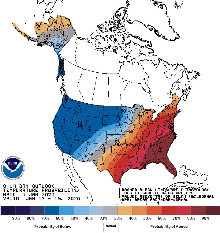
Now there are some signs toward the middle of January of cold - NOT prolonged - but of air that would send temperatures below normal. We've been talking about the pattern turning more active and there will be a series of systems (fairly weak) that will drag down cool air little by little. A stronger storm is looking more likely around the 14-16 of January.

We've gotta take this with a grain of salt because we've seen signs of cold and they models have quickly changed their minds. However, what I want to emphasize is that this will NOT be a long duration cold event. We're looking at a few days of below normal temperatures. The Climate Prediction Center supports this idea as well.
This shot of cold will likely come with some snow, but it's far too soon to know those details. We'll talk more about it as we get closer! And remember - this is a long-range forecast and it's subject to change.
RK


