


NEW SNOWFALL PROJECTIONS...
I am currently at an Apple store located in the Mall of America. While Eden and Carolyn shop for her 16th Birthday clothes, I am surrounded by a couple hundred tech geeks buying products and attending seminars. I managed to wiggle into a lone small seat, powered up the laptop, and pulled down the latest charts on Sunday's weather system.
What I'm seeing is good agreement on the overall development of the storm late tonight and Sunday. I'm also getting good consistency on the northern track I've been anticipating for a couple days.
With that said, here's the latest raw snowfall forecasts. There is no human intervention here, just what that particular model projects. My model of choice is the EURO which has been very consistent for days.
The GFS

The EURO (My model of choice for snowfall guidance)!

The 3K NAM

The 12k NAM

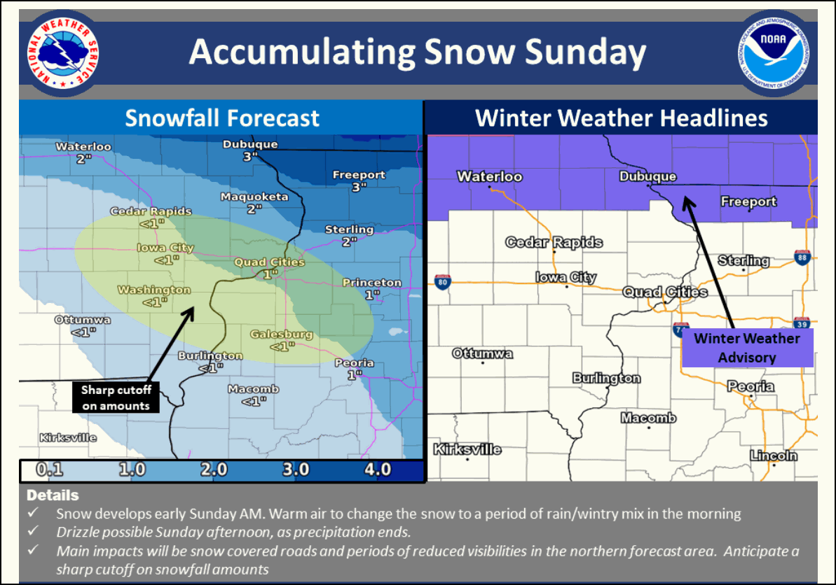
It looks like in most areas except the NW the snow holds off until around daybreak, maybe 4am in far NW. The worst of it should be near and north of HWY 20 where 1-3" seems to be a good estimate (much more north of there). Further south I'm expecting a burst of snow in the early to mid morning that changes to rain for a period before it quickly shuts down with the arrival of the dry slot. Amounts south of I-80 look light and sloppy, less than an inch. Further north closer to HWY 30 an inch is possible (worst case 2") before a little mix and the shut down from the dry slot. The snow will be more consistent near and north of HWY 20 where the dry slot comes into play later. It does look like a very sharp cut-off to the southern edge of the snow band sets up near HWY 20 where a Winter Weather Advisory is in effect.
The NWS in the Quad Cities put this graphic out to help clarify the issue
I do have to run now as I have a concert to catch with my daughter in 2 hours. I'm spread a little thin today here in Minneapolis. The good news for me is that for a change I will get to see the heavy snow tomorrow as I'm in the winter storm warning! Some parts of far southern Minnesota near me could see up to 12". Yippee! I will be back when I can with updates and Facebook lives. Roll weather...TS


