


SEVERE STORMS 101, A NEW WEATHER SCHOOL COMING SOON...
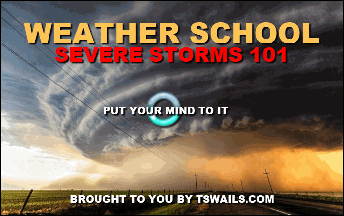
Due to the overwhelming success of our first weather school class back in January, TSwails is thrilled to announce that a new and different session has been created entitled "SEVERE STORMS 101" It's planned for early-April just before the onset of the 2020 severe weather season. Details below.
In this version of Weather School the emphasis will be on severe weather with several special sessions planned. One on the Washington, Illinois EF4 Tornado of Novermber 17th, 2013. The tornado was the strongest ever measured in Illinois during the month of November. Instability was so extreme that a high risk was issued by SPC before the 190 mph winds battered Washington. Shortly after the deadly twister hit, so did winter and the recovery and clean-up was hampered by snow and significant November cold.
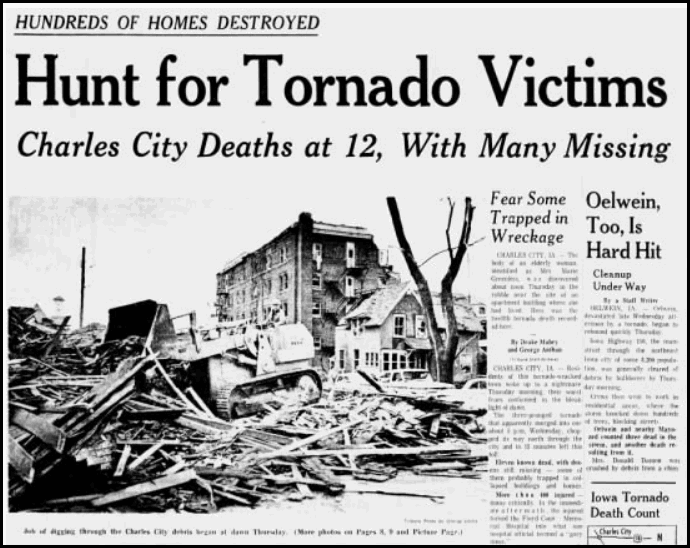
We'll also focus on 2 other significant events in Iowa tornado history. That being the 1968 tornado outbreak that included two EF-5 tornadoes that struck the towns of Charles City and Oelwein on May 15th. 18 fatalities were reported along with 619 injuries. Twin EF5's within 10 minutes and 30 miles of each other are extremely rare and we'll detail what is still considered to be one of the worst outbreaks in Iowa weather history.

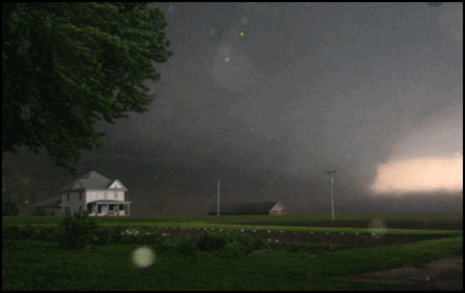
40 years later in 2008, not far to the southwest another EF5 tornado struck Parkersburg, Iowa. This viscous storm leveled a third of the town and produced 9 fatalities. It's considered one of the most violent storms in Iowa history with 205 mph winds. We will document the mesoscale conditions that generated this monster.
That leads to our unique perspective on what's proven to be the Midwest's prime real estate for violent tornadoes. We've researched the data and come up with the most likely spot in the heartland for a violent tornadoes and the reasons why. We'll go in depth on the geographical area in Iowa that's generated more EF5's than 99% of the country. The results will surprise you.
LOOKING FOR A WEATHER SCHOOL SPONSOR
TSwails.com is looking for a financial partner to act as a sponsor of weather school. These ongoing series of regular seminars are geared at educating weather enthusiasts of all ages about the science of weather and it's importance in our lives. TSwails.com has attracted an audience of 10 million people since 2014 and is recognized as one of the premier weather sites in the Midwest. Terry Swails is a trusted name and Weather School is Terry's way of giving back to the community that has supported him for over four decades. It's Terry's hope that funding from civic minded businesses will allow him to expand his programs reach throughout the region with no fees for those attending, especially students. For more information on how your business can work with Terry to elevate its public profile please send an email to terryswails1@gmail.com.
If you want to know why storms form, and what constitutes a rich convective environment we'll lay it our for you with simulations of what to look for in terms of atmospheric parameters. We'll also focus in on soundings. What do balloons and radios tell us about the atmospheres potential to produce supercells and violent storms hours in advance. Not only that, we'll show you the best resources available on-line to pick the spots and storms that will produce the mayhem.
We will also explore the watch warning structure of the Storm Prediction Center and NWS when it comes to risk outlooks and the issuance of warnings. We'll also touch in new technology and research which could give advance warnings more than an hour before tornadoes are expected to touch down. Fascinating stuff.
A session will also be devoted to determining instability. We'll talk about the importance of defining the ingredients known as CAPE and why its so important in predicting the strength of potential storms. On the flip side we'll show how the presence of a "cap" can make the most explosive atmosphere nothing more than a kitten when it overpowers surface instability.
We'll also teach you about radar signatures and what to look for when it comes to pinpointing wind, hail, and tornadoes.There's far more to see than just a bunch of colors. It's still the ultimate tool to have when storms erupt and are on the move.
We plan to simulate the 2011 super tornado outbreak that killed 317 people in Alabama. We will walk you through the early analysis that led to days of notice and vital outreach. From Storm Prediction Center discussions, high risk assessments and PDS watches you will see how the dominoes were aligned for tragedy. We'll walk you through the staggering parameters and let you see what forecasters saw...the perfect ingredients for destructive and deadly long tracked tornadoes.
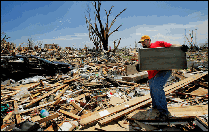
As an added bonus we'll show you some of the most remarkable tornado videos ever taken, You will feel the power and terror of natures most violent storms like never before. I guarantee you will have a newfound respect for the power of nature and our ability to predict the fringe elements of severe weather that take 71 lives a year and produce more than 400 million dollars in damage.
The one-day forecasting seminar for weather enthusiasts will be held at Terry's home in Marion, Iowa, Saturday April 4th. Along with the head master T. Swails himself, meteorologists Rebecca Kopelman and Nick Stewart of KGAN TV will be there to lend their knowledge and experience to the discussion. It will be fun, informative, and factual. We hope you can spend the afternoon with us!
The seminar will be held April 4th and will last from 1:00 until 5:00pm. We have limited seating and the cost is $89 dollars per person. Refreshments will be provided. Again, not a lot of seats so reservations with a pre-payment are required. Sorry, no refunds.To register or get additional information send an email to carolynswettstone@yahoo.com


