


RECORD COLD AND MORE COLD COMING...
May 9th and we're setting record cold temperatures because that's what 2020 seems to do. Unseasonably cold air moved in and led to temperatures well below freezing Saturday morning. A very late season freeze and frost for the Upper Midwest (even the east coast got into some snow!). Here's a look at some of the low temperatures and records in my local area via the National Weather Service in the Quad Cities:

Just to show how unusual this is, here's a tool we can use to track where the air mass came from..showing the air originated in the arctic!

This air clearly doesn't belong here, especially in May! And unfortunately another cold front Saturday night into Sunday is going to keep this cold air around as we head into next week. Rain and even snow will fall in parts of the Upper Midwest through much of the day Sunday:

The cold air, clouds, rain, and a strong north wind will all hold temperatures down around 10 to 15 degrees colder than Saturday.

Sunday night into Monday the clouds will clear and winds will die down. Temperatures will once again drop down to near the freezing mark, leading to another chance for frost.

Then once again Monday night into Tuesday there will be the potential for a freeze/frost.

Once we get past that things begin to improve. We go from troughiness in the upper levels: northwest flow, cold, dry through the first half of next week.

To a ridge, not overly strong, but warmer air from southwest flow in the upper levels:

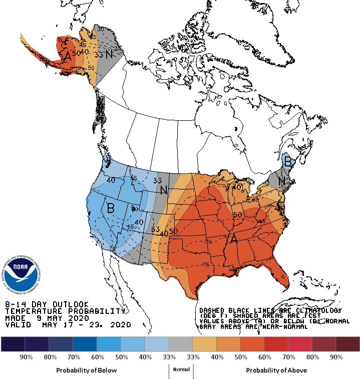
And that's reflected in the Climate Prediction Center outlook for May 17-23
We still have some frost to get through but if you've been waiting to plant of jus waiting for spring in general... here it comes!
RK


