


A TURN IN THE ROAD AHEAD FRIDAY...
Tuesday was another warm summery day featuring scattered thunderstorms. A tornado watch was even issued for my western counties. Tornado reports were confined to brief small spin ups with no apparent damage. There were a number of thunderstorm warnings but in most instances little more than gusty winds (downbursts) and brief gully washers occurred. Here is what the Storm Prediction Center shows for reports.

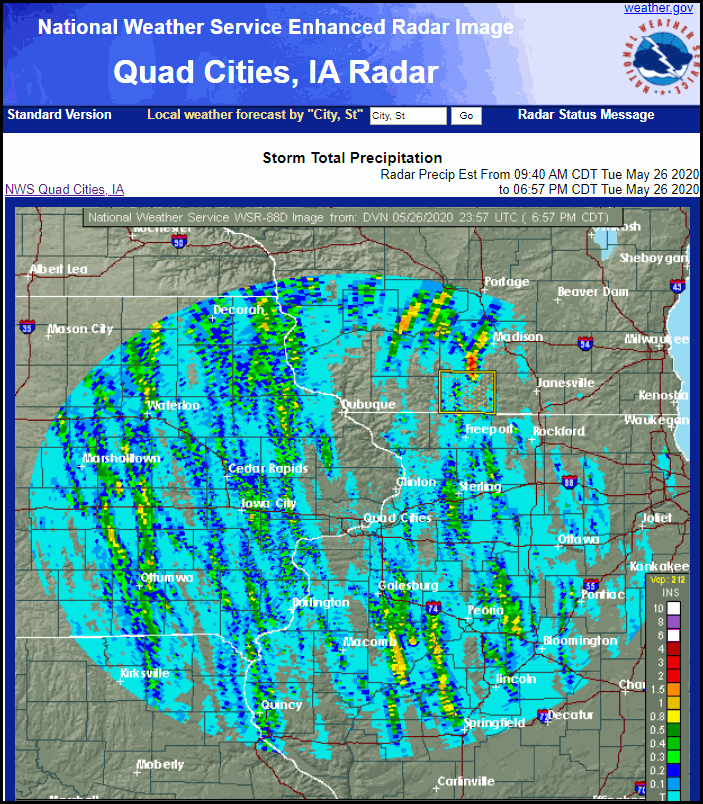
Rainfall was spirally banded as you can see in the Doppler estimates through Tuesday evening. Some spots picked up 1/2 to an inch of rain while others remained relatively untouched with some isolated locations seeing no rain at all.
There was enough sunshine to produce highs in the mid 80s with the Quad Cities soaring to 88 degrees. That's the 4th consecutive day for many to see an 80, the first time that's happened all year.
Wednesday and Thursday will be similar in that the area resides in warm humid air that will be unstable enough for scattered thunderstorms when convective temperatures are reached, especially in the afternoon and evening. While a strong storm is possible severe weather should be isolated and confined to gusty winds and downpours. With slower movement of any storms locally heavy rains are a good bet where they develop. The EURO has this for rain totals through Thursday night.

The GFS has this for the same time period.

Cloud cover is likely to be more extensive than the past few days and that should cut a few degrees off of highs as they go back to 80-85 Wednesday to 75-80 Thursday.
Thursday night I see a turn in the road when a healthy punch of cool air arrives in the form of a cold front. That quickly scours out the warm moist air and brings temperatures down to cool but pleasant levels over the weekend. You can see the change projected in temperatures on the EURO.

To give you an idea how fresh this air mass is lows both Saturday and Sunday morning are projected to get into the 30s over the upper Midwest with 40s over much of my area.
Saturday morning lows.

Sunday morning lows.

Early next week a robust southerly flow returns on the back side of the high that delivers the fresh weekend. That quickly drives temperatures back above normal , a trend that looks like it could stick around much of the period June 2nd through June 8th.
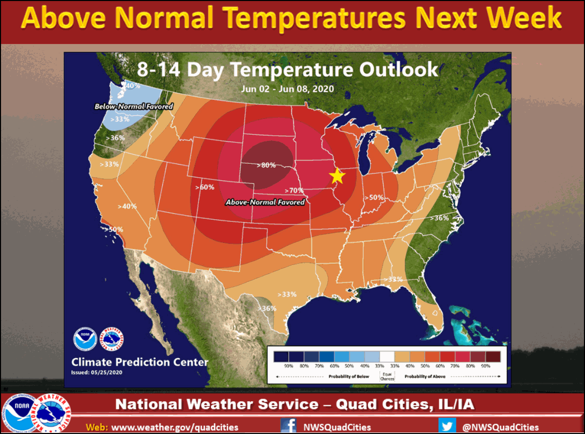
The long term pattern next week also has the look of one that could be active with MCS complexes that are common to the Midwest in June. We'll cross that bridge when we get closer in time. Meantime, it's status quo today with more of the same. Roll weather...TS


