


IT'S A WRAP FOR THE RAIN AND WARMTH...FOR NOW!
Last night I showed you some data on how wet May has been east of the Mississippi in my area. Northeast Illinois has really been soaked as evidenced by the fact Chicago (now with 9.30") has set its all-time total rainfall record for the month. As soggy as that is it pales in comparison to the wettest month ever which was 17.10" in August of 1987.

Here's the all-time monthly records for all months in the Quad Cities and Cedar Rapids.
Quad Cities (Moline Airport)

Cedar Rapids

For the entire state of Illinois, on average these are the all-time wettest months on record..

For the state of Iowa on average the wettest month and year.

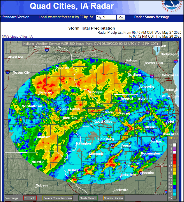
Thursday was another day where locally heavy rain fell again in my area. Fortunately this time it was concentrated more in eastern Iowa which has been drier and could absorb the downpours better than areas in Illinois. The largest total I saw was 3.50" around Independence which caused flash flooding in that area. Some 1-2" totals around Savannah and Mt. Carroll, Illinois caused some issues in Whiteside, County as well. These are Doppler estimates through Thursday evening.
As I've been saying all week this is the end of the rain for awhile in my local area.as a 1027 mb high settles over the Midwest come Sunday morning.

That leaves the upper Midwest and Great Lakes dry as a bone with water vapor at 20-40 percent of normal.

The dew points in NC Wisconsin sink into the 20s Sunday morning. That's about as low as you will see them May 31st.

That leads to lows in the 30s and frost is quite likely in the low lying areas of the northland. Lows in my area should dip to the low to mid 40s. That's plenty chilly but well above records which in most areas are in the range of 34-40. Still, enough already.

During the warmest part of the day readings will be well below normal with highs Friday through Monday remaining in the range of 65-70. To give you and idea of how cool that is these are the departures over the central U.S. early Sunday afternoon. Lots of spots 8 to 20 degrees short of what's typical.

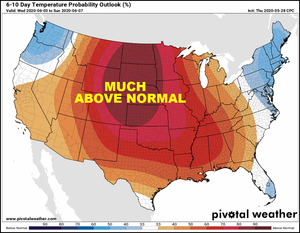
Finally southerly return flow kicks in on the back side of the high and readings steadily warm to above normal the majority of next week. That trend should hold for awhile as the 6-10 day temperature outlook has above to much above normal readings June 6-10th.
The next shot at precipitation comes Monday or Monday night as warm air advection kicks in with the return of summery conditions to the central Midwest. Happy Friday and roll weather...TS


