


A LITTLE BREAK FROM SUMMER
- May 30, 2020
- 1 min read
Drier air has taken over and it feels pretty nice outside. Now the sun is strong this time of year and it still feels pretty warm but by the numbers it is dry.

Dew points (the humidity) Saturday evening were in the 30s and 40s across the Upper Midwest. That is dry air - especially this time of year. Especially feels nice when just a few days prior we were dealing with dew points in the 60s and 70s. This dry air will continue into Sunday...
Then, in the upper levels, a big ridge of high pressure moves in and will bring the warm, muggy weather back.

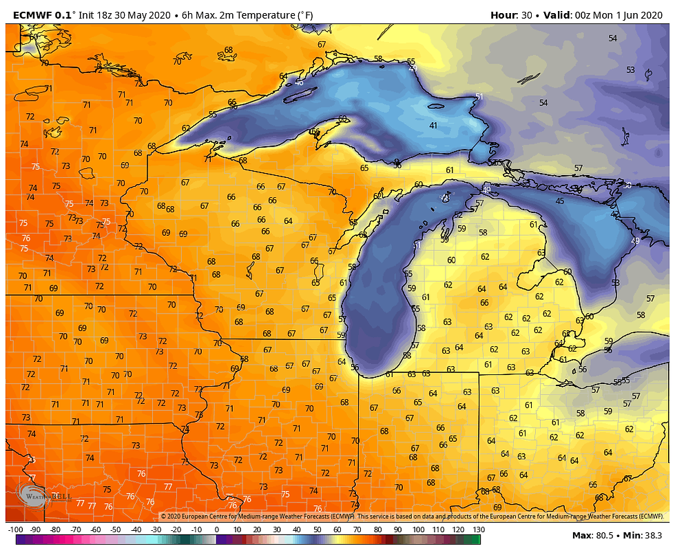
As a result here's high temperatures Monday:

Then Tuesday:

And then on top of that there will be heat index values well into the 90s due to dew points well into the 60s and 70s Tuesday afternoon --

With the warmth and mugginess will come moisture and instability for showers and thunderstorms. There will be the chance for some rain Monday but the higher chances come Tuesday night into Wednesday.

There is the potential for some strong storms with this system but we'll have to assess as we get closer. Warm, summery weather will continue through next week, though.
RK


Comments