


LET THERE BE RAIN...
Finally, the rains have come to the central Midwest. They were hard earned and very much needed. This was the rainfall departure for the period August 1st-September 5th. Some greater than 4 inches.

Then came this impressive fall storm (remnant energy form a Pacific typhoon) and how things have changed

This Doppler estimate is out of Des Moines. It shows rainfall from Saturday night through Tuesday evening.

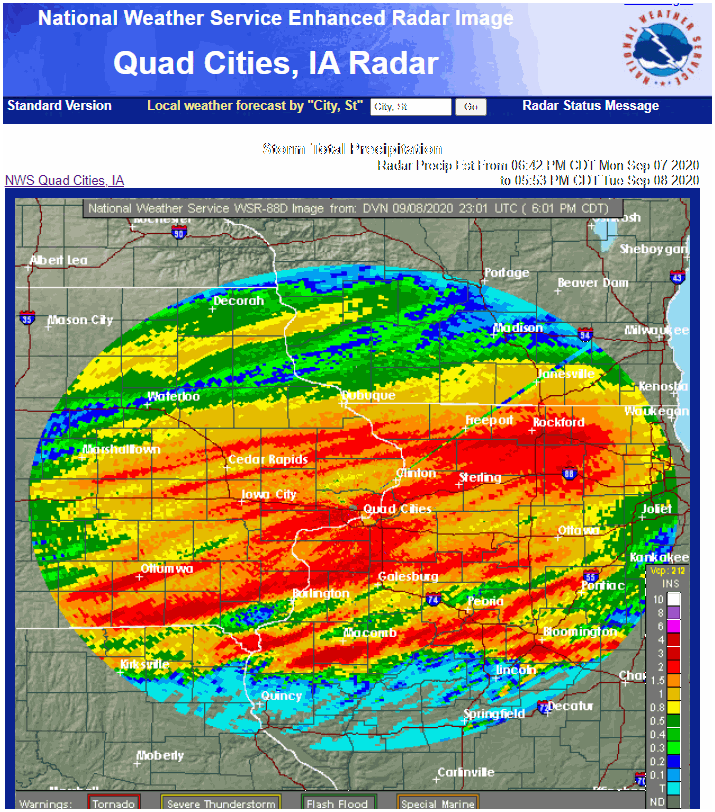
This estimate form the NWS site in the Quad Cities shows amounts from Monday night through Tuesday evening. Widespread 1-3" totals are indicated.
Throw in what fell over the weekend and you can see some some places in my area in just 3 days eclipsed what had fallen in the previous 5-6 weeks. Making up for lost time there.

The system will keep on giving too as it only slowly grinds across the region through Saturday. From here on out, additional rains will be more controlled and stratiform in nature until perhaps the weekend. As a result rainfall rates will be much lower and so will be amounts. There will also be windows where no rain falls between passing rounds of vorticity/energy. In other words, there will be nice breaks where no rain will fall. Here's what several of the models are showing for additional totals.
The GFS (out to Sunday)

The EURO (out to Sunday)

The Canadian GEM (out to Sunday)

The 3k NAM (out to Thursday night)

The 12 NAM (out to Saturday morning)

As you can see there is quite a range in overall amounts. However, it does seem likely that at the very least many spots by Sunday could see another inch of rain before this thing departs (maybe two in spots).
By the way, did you notice the temperature change Tuesday? Readings barely above 50, 30 mph winds along with occasional rain and drizzle was a real eye opener, especially after 90s Sunday. You can see departures of 20-45 below covering a large chunk of real estate.

Tomorrow won't be much different.

Some slight improvement is expected Thursday and Friday but still well below normal highs are expected. Finally, we should get back close to normal Saturday and Sunday.

By the way, this picture was taken in Colorado by Conrad Meyer. The dogs face reflects what many people in that state are looking like after temperatures went from 100 this weekend to cold and snow Tuesday. Take care everybody and roll weather...TS


