


40 DAYS AND 40 NIGHTS...
I wouldn't call it biblical but after a two month stretch of dry weather, the last week certainly has earned an honorable mention after producing some heavenly rainfall totals.Widespread 3-6" totals have been observed across much of my area. Localized spots have had as much as 7-8 inches. These are the 7 day rainfall estimates. These only go through Thursday morning so significantly more has fallen and is not incorporated in the graphic.

The 7 day rain as a percent of mean.

The 24 hour amounts from Wednesday morning to Thursday morning.

Last week the drought index looked like this.

A week later we have evolved to being so wet a flash flood watch was issued for many of my western counties by the NWS in the Quad Cities.

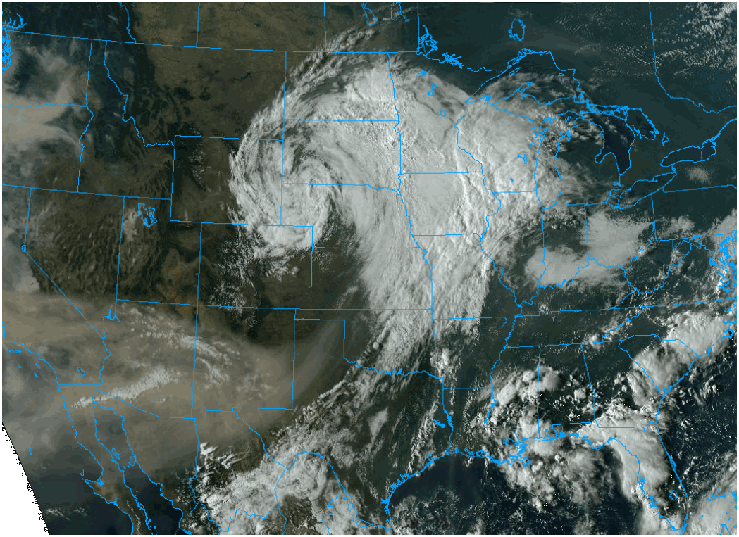
The big storm is on the move though and the rain threat will be out of here by Sunday The upper air low at the time of the posting has lifted from Colorado to South Dakota.where it will be absorbed in the westerlies and raipidly depart.
It will still be close enough to keep scattered showers going through Saturday morning although they will end early from west to east in my Iowa counties. A final piece of energy will pivot through Saturday night bring some light showers and then it's over for good come Sunday. These are projected rainfall amounts through Saturday night. The majority of this occurs Friday night.
The EURO

The GFS

The GEM

The 3k NAM

The 12k NAM

By the way, Friday was the 4th consecutive day in Cedar Rapids with a high in the 50s. I don't have the figures on that but it could be the first time on record with a string of four 50 degree highs before September 12th.
Once we get this behind us the 500mb pattern flattens for the first half of next week allowing mild dry conditions to return to the Midwest.

That's the long and short of it for now. Enjoy your weekend and roll weather..TS


