


TWAS A MARVALOUS START TO FALL...
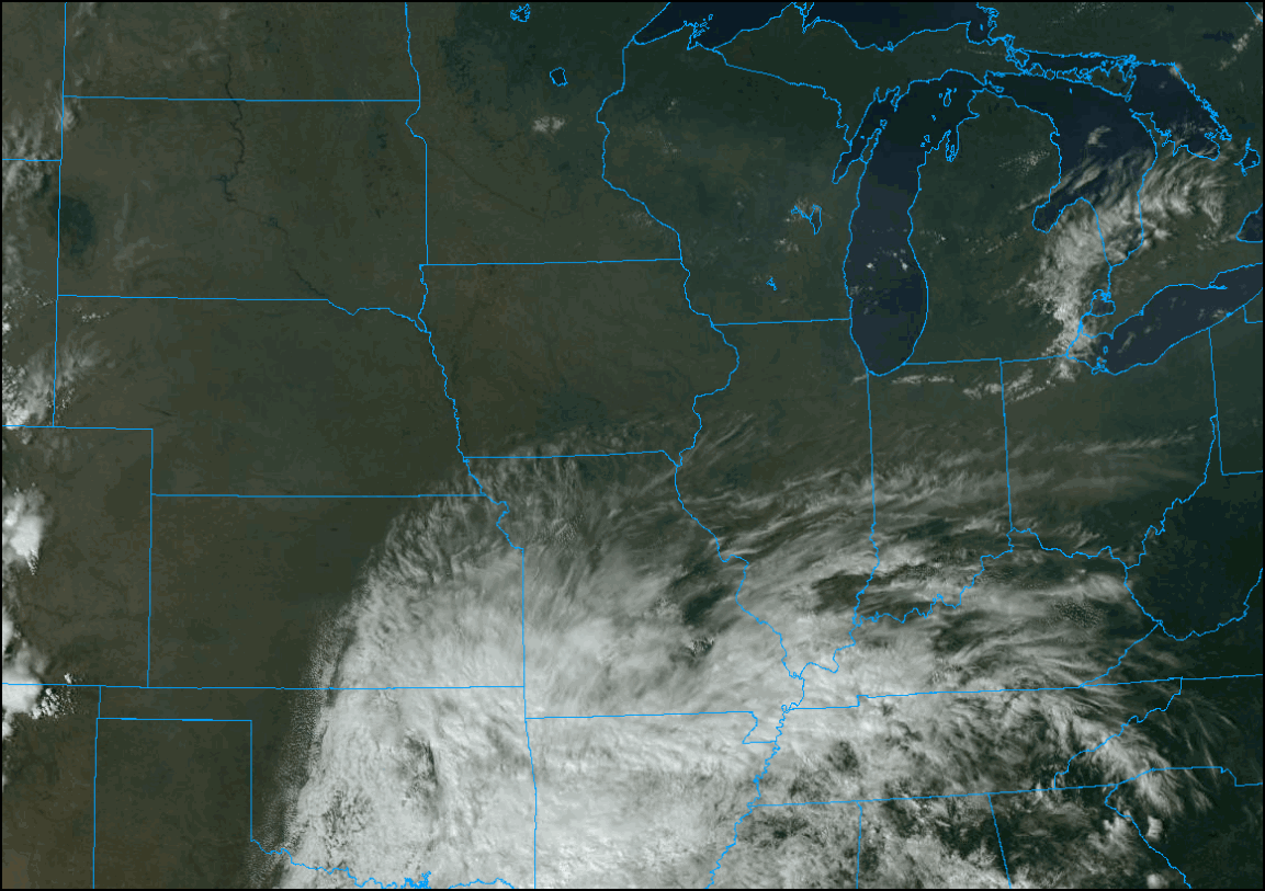
The first day of fall left nothing to be desired across the central Midwest. Sunshine and mild temperatures ruled, picture perfect as the saying goes. While we still have some more of this on our plate, starting next week the the weather menu gets less tasty. Here's what Tuesday's beautiful day looked like from the perspective of the GOES 16 satellite.
The coming pattern change (as typically is the case) will be initiated by a re-alignment of the storm track. We go from this at 500mb Wednesday.

To this a week later.

That's a decidedly different look with significant implications. Below you can see how mild we are before the change with temperature departures that are well above normal.

After the change, we are well below normal.

The experts at the Climate Prediction Center are noting the trend showing a moderate risk of much below normal temperatures over my area October 2-4th.

Here's what CPC has for temperature and precipitation departures in the 6-10 day period ending October 2nd.
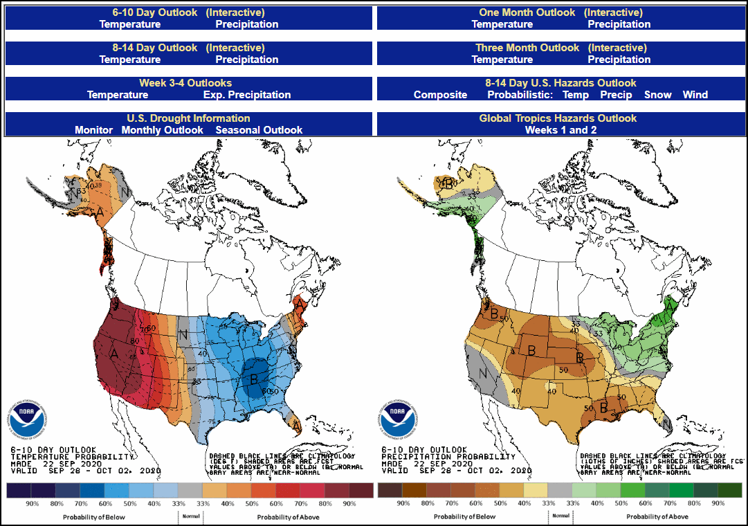
And now the 8-14 day period ending October 6th.

Aside from the cool-down the outlooks reflect well below normal rainfall. Today was the 11th consecutive day with no rain in most of my area. Below you can see how dry the past 7 days have been over much of the Midwest.

Compare that to the 7 day period September 4-11th when daily rains accumulated 4-8" plus.

If the GFS is right, the next 16 days are likely to see little if any rain. There is a chance for showers Thursday with a weak disturbance. Moisture is limited so amounts should be light (if any) and the north half of my area most favored for what might fall. These are the 16 day rainfall departures on the EURO.

Meanwhile, Wednesday will see a few more clouds but overall enough sunshine is expected to foster another mild day with highs generally in the mid to upper 70s. Overall, another keeper. Roll weather...TS


