A TRUE TASTE OF SUMMER...
- May 8, 2022
- 2 min read
Summer is coming to the Midwest after we finally got a taste of spring. Now heat, humidity, and storms will all be on the table next week. It starts Monday with a mix of sun and clouds and winds picking up out of the south. Temperatures will climb into the 80s for just the second time this year:

The humidity will rise into the uncomfortable range... be prepared if you're going to be working outside or just outside in general:

A cold front will move through in the evening and ahead of it the instability will be high:

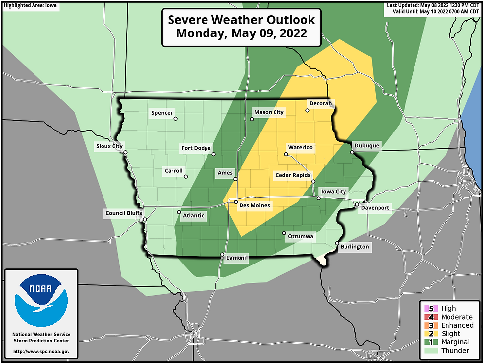
There is uncertainty on how this day pans on exactly due to the capping that will be in place. A cap is warm air aloft that suppresses thunderstorm activity. T. Swails always compares it to when you shake a pop bottle and you can see the energy inside... someone just has to open up the bottle to set it free. The question is when is the cold front able to open the lid on the atmosphere? If it happens in the afternoon/early evening then the threat for tornadoes will be elevated. If it happens later, then hail and strong winds will be the main theat. The Storm Prediction Center has upped the risk to a slight (2 out of 5 on the scale):

The HRRR is showing a later solution with mainly that wind/hail threat:

There will be a lot of shear (spin) in the atmosphere so we'll certainly be keeping our guard up.
Tuesday will be another toasty day:

There will be another chance for thunderstorms late Tuesday into Wednesday:

There is uncertainty on placement... we'll have to take this week day by day. Get ready for summer!
RK


Comments