IT DOESN'T GET MUCH BETTER...
- Jun 16, 2022
- 2 min read
A change is underway that will bring sensational weather to the region this weekend. Temperatures were already cooling Thursday but the biggest difference was in the dew points (how we measure moisture). They had plunged from the low to mid 70s to the mid and upper 50s by afternoon. The day started nice too with fresh NW winds and temperatures 10 degrees cooler than just 24 hours earlier.

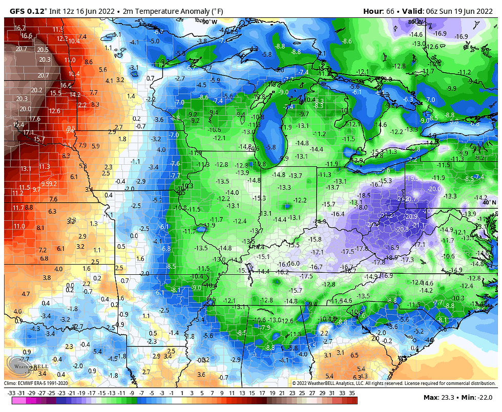
Going forward conditions will get even better as temperatures lower further and dew points crash to the 30s and lower 40s. Just look at these numbers early Sunday morning.

That allows lows to reach the low 50s, perhaps the upper 40s in some of the low lying valleys of EC Iowa and NW Illinois. That's hard to do when nights are at their absolute shortest.

Those readings are a good 10-12 degrees below the norms.

As for high temperatures, they are looking good. This is the EURO ensemble's meteogram for the Quad Cities. Readings in the upper 70s to low 80s will be fantastic when combined with the bone dry air and abundant sunshine. Mild during the day, pleasantly cool at night. That my friends is a first rate weekend.

The pleasant weather comes to an abrupt halt Monday and Tuesday as the ridge that brought the recent steam rebuilds over the central U.S. A quick return to hot humid weather is expected at that time. There may be a small break again towards mid-week but overall the ridge looks to be a major player the next 10-14 days resulting in well above normal temperatures. In the 500mb animation below you an see how the ridge blossoms next week and dominates the flow over North America through June 26th.

The 7 day period June 19th through 26th looks very toasty, at least on the EURO. Here's it's temperature departures over that period.

The EURO long range meteogram indicates a long stretch of 90 degree days.

That's essentially what CPC shows in its 8-14 day outlook.

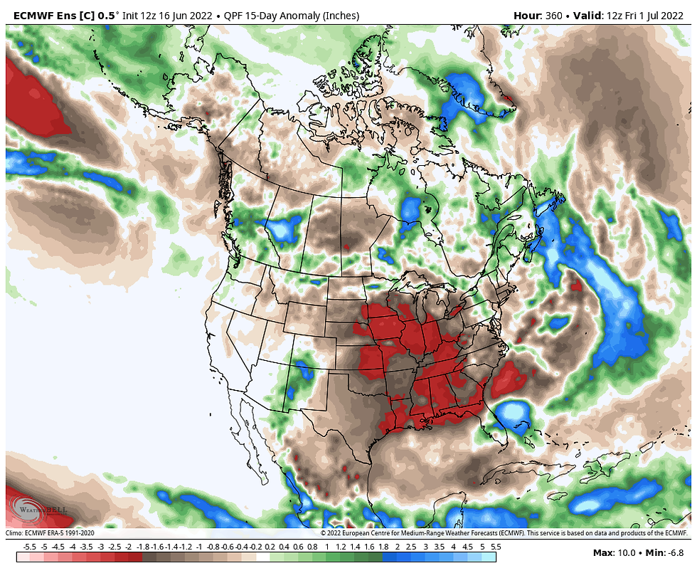
What concerns me the most is the lack of rain that's shown over much of the region. Here's the 15 day rainfall departures on the EURO.

A closer inspection reveals much of the area accumulating rainfall deficits well over 2 inches during that time frame.

That combined with the heat and already abnormally dry soil conditions in some of my northern and western counties could put some real stress on crops, grass, and gardens. Something to watch.

Here's the rainfall departures around the region since the beginning of April...the start of the growing season. Note that some parts of my area are already down 4 inches during that time with what looks to be a dry period coming. That's a bit concerning going into the hottest time of the year. Also a time when the rains become far more hit and miss in nature.

There's always something to gripe about in the weather but at least this weekend the complaint department is closed. As the saying goes, it doesn't get much better than this. Happy Friday one and all and as always, roll weather...TS


Comments