ROUNDING THE BEND...
- terryswails1
- Apr 22, 2021
- 2 min read
I've probably said it a thousand times and I'll say it again, I'm no fan of April. The month is schizophrenic. Nice one day, mean as a junk yard dog the next. This year has been especially freaky. Just look at the temperatures to date in Cedar Rapids. Talk about extremes. Unfortunately we've had more cool than warm with 16 below normal highs and only 7 above. 9 days have been below freezing including lows of 18 and 20 degrees.

We are headed for a nice warm-up next week but not before 3 more days with below normal highs. Before I get to that, there is a disturbance that will bring some showers into the picture Friday night and Saturday. The best dynamics and moisture remain well to the south so totals in my area will be light with the highest totals (up to 1/4") southeast of the Quad Cities. The EURO shows this for rainfall.

The GFS is further northwest and a bit more robust on amounts. Right now I do not favor its solution.

Whatever happens, temperatures remain cool with readings Friday and Saturday mainly in the mid to upper 50s. Sunday may even be cooler, especially in the north where highs up near HWY 20 might struggle to get much above 50.
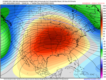
About this time the storm track undergoes a major change from an eastern trough to one that is centered in the west. See it unfold below.

Look what that SW flow does for temperatures. We go from negative departures like this Sunday.

To positive ones like this Monday. That's a big turn around in 24 hours.

You can see the 10 day temperature breakout on the EURO meteogram for Cedar Rapids. That's a sight for sore old eyes.

Precipitation chances return Tuesday night and perhaps Wednesday but there is disagreement with regards to frontal positions and forcing which will no doubt impact totals. Dew points are projected to get into the 60s which would be ample fuel for thunderstorms and perhaps some downpours where conditions do come together. This is what the EURO and GFS show for rain amounts the middle of next week.
The EURO

The GFS

By the way, my first full day back in Iowa in a year will be Monday...the EURO is projecting 78 that day. How about that for timing! Let's keep rounding the bend!
Anyway, I need to wrap this up as I'm packing up the truck with my remaining belongings. The wife, kid, 2 cats, and a dog all get loaded early Friday morning. Our destination will be Buffalo, New York where my next post will originate from. Hope I can get some sleep tonight. I'm pretty excited about getting back to Iowa soil. Stay tuned for more on "the road to Iowa", snippets of our trip home. Roll weather...TS


Comments