


COOKING UP A LITTLE WARMTH...
- Sep 11, 2017
- 2 min read
For many weeks I have alluded to the cool weather that's prevailed around the Midwest going back to late July. I've also indicated on numerous occasions that I felt a warmer pattern would return come mid to late September. That change appears to underway and you will feel what I'm talking about by the end of the week.
Here's September's departures.

And here's those for August to get some perspective on the duration of the cool weather.

Now look where the 500mb jet is expected to be by the end of the week. A much warmer look as the ridge that's been over the west the past 6-7 weeks is replaced by a trough. A complete flip-flop!

The 5 day temperature departures on the EURO show warming spreading east through Friday.

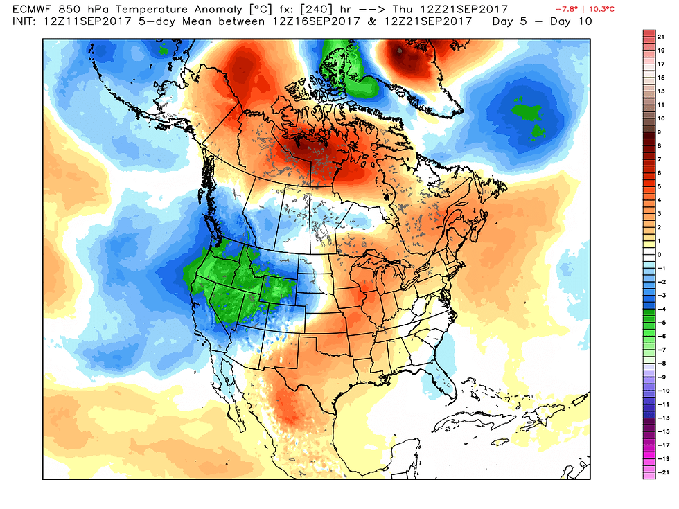
Days 5-10 the greatest anomalies are centered on my local area.
The peak of the coming warm-up is expected Friday and Saturday when highs could approach 90 in some parts of the central MIdwest. Here's what the EURO is showing for highs Friday and Saturday. I suspect these numbers might be 2-4 degrees too warm but it's a long ways from the 60s and 70s we've been seeing.
Friday highs:

Saturday highs:

One good thing about the warmth is that it won't be accompanied by humidity. Dew points are only expected to be in the upper 50s to low 60s.

That yields humidity levels around 35-40%

More important than the warmth is the lack of rain much of the central Midwest is dealing with. Here in Cedar Rapids we have built a rainfall deficit of just over 9" since May 1st. That is quite significant and the dryness is really showing the past couple of weeks.
As I see it now the first chance of any rain doesn't even exist until Sunday. At that time we could see some scattered showers and storms but I'm thinking the more beneficial amounts may stay to the north, more into Minnesota and Wisconsin and perhaps far northern Iowa.
On a brighter note for rain, the EURO weeklies are more bullish on amounts long range. The 32 day control has this for rain ending October 13th. Some 5-7" amounts in drought stricken southern Iowa.

The 32 day means are not so optimistic with most of the Midwest in the 2-3" rainfall range. That's much closer to normal and i think more realistic.

There's a saying that in times of drought signs of precipitation don't pan out. Until I see a widespread rain I'll be very skeptical of any models optimism outside of 2-3 days. Roll weather...TS


Comments