


CALMER TIMES AHEAD...
- Oct 15, 2017
- 1 min read
After a gloomy Saturday cool air settled in to the Midwest and it was a chilly, windy fall day. Beneficial rain did fall though on Saturday - here's a look at the totals:

This has contributed to the already above normal precipitation for the month of October.

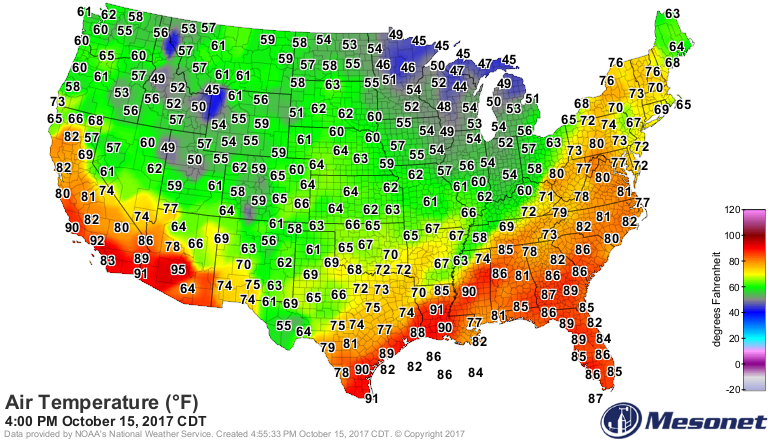
Dry air rushed in and winds picked up out of the northwest. The cold air moving in along with cloud cover temperatures were held in the 50s Sunday afternoon.
Skies are clearing through the night and winds will die down. Some parts of the Midwest may experience their first (or even second) frost of the season.

This will likely be the coldest night since early May for parts of the Midwest and the coolest night for at least the night week.
On Monday, temperatures will rebound under some sunshine to seasonal values and nearly 10 degrees warmer than Sunday.

The weather will remain calm through the week with high pressure at the surface in control. High pressure will build in the upper levels in the atmosphere and lead to a warm up.

The next change won't come until the end of October - something we've been hinting at for a while. You can see the trends over the next 15 days:


After a warm up this week.. looks like the bottom will fall out.
RK


Comments