MIGHTY MISSISSIPPI NEARING ALL-TIME RECORDS IN SOME AREAS...
- terryswails1
- Apr 29, 2019
- 2 min read
The past 7 days have been active ones around the Midwest. Rain and snow has added up, especially the past 3 days where some places around the Quad Cities have had more than 4" of precipitation. All that water on top of saturated grounds.

With more rain expected Tuesday and Tuesday night a flash flood watch has been issued for SE Iowa and WC Illinois in my area. I'm not expecting widespread problems but some urban flooding and rises on area rivers and streams can be expected

One river that's of primary concern is the Mississippi from about Le Claire southward. Currently, a crest is working its way downstream approaching the Quad Cities. The recent rains and those to come have increased projected crests. It now appears the river will come close to the all-time record levels set in 1993.

This image shows President Bill Clinton and Governor Terry Branstad overseeing the 1993 flood in downtown Davenport. I remember it well.

Here's some additional forecasts stages from Camanche south to Burlington. Notice on the right that these could still go higher if rains are more than anticipated. Keep abreast of the latest updates from the NWS in the Quad Cities.


Here are some of the latest rainfall forecasts utilized to make the forecast crests.
The NAM

The 3k NAM

The GFS

The EURO

The clouds and rain that develops Tuesday will see to it that temperatures remain quite chilly and well below normal. The GFS depicts highs in the 40s and low 50s. That's not sitting well with me.

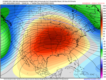
Looking ahead the EPO (eastern Pacific oscillation) is forecast to remain strongly negative into mid-May. That should mean a continuation of this cool wet pattern until it breaks into positive territory. This type of set up could really hinder farmers in the fields over the next couple of weeks. More on this predicament in coming posts. Roll weather...TS


Comments