O-MEGA-A MESS...
An omega block situated over the United States has blocked the westerlies from dominating the nations weather as they usually do. You can see what I'm talking about below by following the 500mb jet stream heights. They enter California and then veer directly north over the Rockies into Canada before re-entering the U.S. over the northeast. From here they cut back into the Ohio Valley before sweeping south into the Gulf. When this happens we lose the westerly steering currents and things don't move much. That that is why Tuesday was more or less a repeat of Monday in terms of sensible weather.

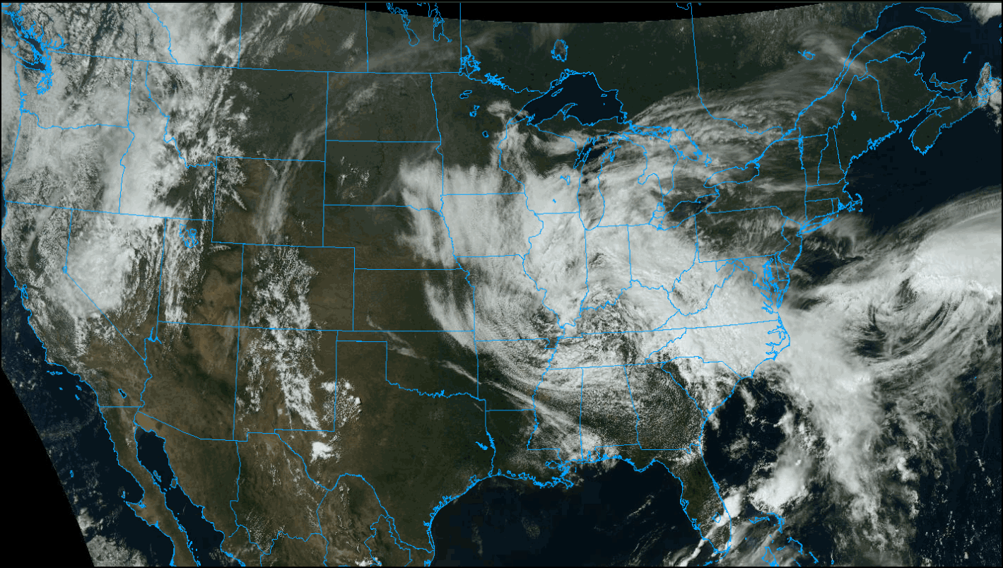
Going forward the block slowly fills and weakens and that means a gradual return to sunshine and warmer weather as the week wears on. However, Tuesday was again a losing battle for sunshine and the warmth that's typical this time of year. Here's the clouds pinwheeling around the upper air low which has only moved about 400 miles in 2 days...not much by weather standards.

The clouds and northerly winds combined to keep mid-day temperatures Tuesday a good 5-10 degrees below normal.

As I mentioned the upper air block gradually breaks down and Sunday the 500mb pattern has changed to look like this. The central Midwest is now in southwesterly flow and that opens the door to a much more moderate brand of weather.

These are the temperature departures Sunday. We go from 5-10 below Tuesday to 10-15 above.

If the EURO is on target that should mean highs near 80 Sunday. Perhaps the warmest day of the year so far!

Before this happens we experience a gradual warm-up going from near 70 Wednesday, to the low 70s Thursday and Friday, and the mid 70s Saturday.
Now the knock. The southwest flow will begin to draw moisture northward and that means rain chances will be on the increase Friday night as the warm air advection kicks in. That scoots rapidly east and we should get a break Saturday and then showers and storms become more likely Sunday and perhaps parts of Monday. Below you can see the available water vapor increasing dramatically by Sunday to 1.50" (there's a 2,00" bullseye around Kansas CIty)

That should raise the dew points with the EURO showing readings around 70 Sunday afternoon. That produces the first really sticky day of the year.

That also creates the instability that drives thunderstorms and I am expecting some of those out ahead of a front Sunday. Some decent rains are possible. More storms are a threat late Monday near or east of the Mississippi along the slowly advancing front. The timing will be critical with regards to any severe threat Monday Something to watch. Below you can see the early read on holiday weekend precipitation based on the EURO.

To sum it up, there will be some chances for rain over the holiday weekend but there will be many dry hours and with temperatures in the 70s to near 80 there will be a summery feel to the air. All things considered it looks like a keeper to me. Roll weather...TS


