A LA NINA WINTER AHEAD
- Nov 8, 2025
- 2 min read
Nick is sailing the Caribbean with his lovely wife. Due to concerns with internet, he packaged a couple of special pieces designed to give me a break and you something interesting to read and learn from. Here's hoping the weather is far warmer than what we are dealing with here. Smooth cruising, Nick and Mary!
A LA NINA WINTER AHEAD

Globally, two major features stand out across the oceans as we get closer and closer to meteorological winter. For one, the incredible warmth off the west coast of the United States will continue to be an influence to upper air patterns. The other major point of interest is the equatorial waters of the Pacific where we watch for El Niño and La Niña, which is a major driver of weather patterns in North America.

Compared to climatology, the waters continue to cool in the eastern Pacific along the equator as La Niña conditions continue to strengthen. As of the latest report from the Climate Prediction Center, the anomalies are -0.6°C. The threshold for La Niña is -0.5°C, however there is also a time function as well that we haven't quite reached.

Latest model guidance has La Niña thresholds continuing into late winter, which would likely be long enough to be considered full-blown La Niña. This would be slightly stronger than last winter's La Niña, in which we didn't quite get the magnitude and duration for it to be considered a true La Niña winter.

Looking through past years, recent examples of La Niña winter include 2020-2021, 2021-2022 and 2022-2023. Farther back, you can add 2016-2017 and 2017-2018. We have had numerous examples in the last couple of years. In terms of similar strength, winter 2016-2017 and 2022-2023 are the closest analogs to look at.

Those two winters were remarkably similar in terms of total snowfall December 1 through March 31, right around 22" for the Quad Cities. The 30-year average for the area is 32.4", so about two-thirds of normal. This could imply less snow this winter, but the sample size is somewhat limited here.

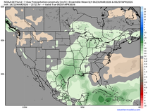
Expanding the analog pool to all La Niña winters since 1990 there is a pretty high chance of near-normal precipitation locally, and even a very slight above-normal signature closer to northern Illinois.

In terms of temperatures, we notice anomalies in the Midwest are slightly on the cooler side of normal for the upcoming meteorological winter. This is pretty consistent with the conceptual models for La Nina.


The current winter outlook from the Climate Prediction Center is about what I would expect for temperatures, although it is a little on the higher side with above-normal precipitation across the Great Lakes region which, just given recent La Niñas, would overperform.
As always, seasonal forecasts are always a challenge and depend on so many variables to pan out correctly. It only takes one really good winter storm to make all the difference and make it a memorable winter, but this is what we see based on what key patterns are telling us today.
Have a wonderful weekend everyone!
-Meteorologist Nick Stewart


Comments