


A LULL IN THE ACTION
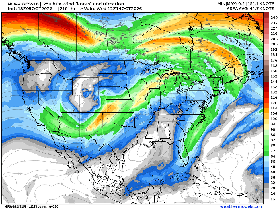
I could just post a sentence or two and that would cover the next week of weather across the Midwest. But I'll give you a little more than that, but trust me I am stretching. Starting off, not much really excited me until next week. We are watching a storm system in the Tuesday/Wednesday October 13-14 time frame that will likely be an abrupt pattern change bringing in much cooler temperatures and our next chance at meaningful rainfall. Strong upper-level support will usher in a storm system with a cool hit of air on the back side.
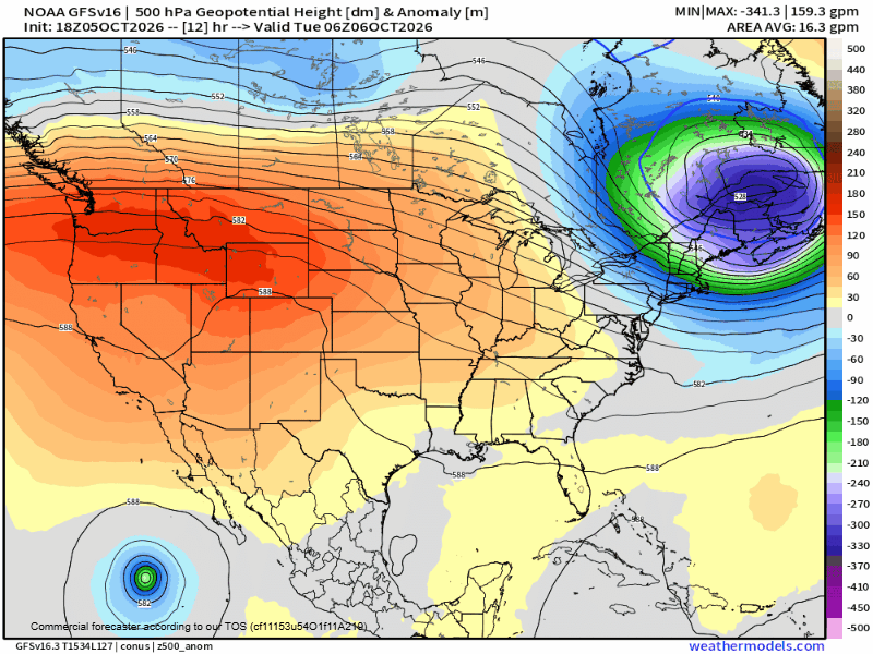
Before we get there, a strong ridge across the central US really keeps the weather pattern quiet. This ridge also opens the door to some tropical michief in the Gulf. While not a solid forecast yet, odds are increasing Louisiana through the Florida Panhandle will be on the lookout for a possible tropical system late this week and into the weekend. That should have no impact on us, but what is keeping our weather quiet is what will allow that potential development.
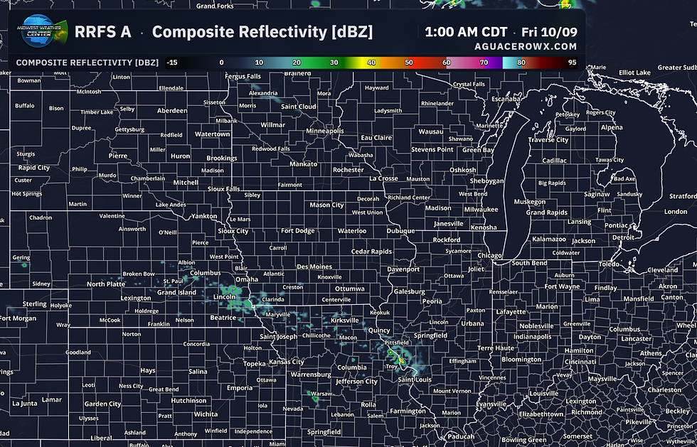
There is a very slim chance for some light showers late Thursday into early Friday but high resolution modeling coming into range has really suppressed that potential. I don't see much there that get's me too excited in terms of rainfall. Best chance may be far southern Iowa into northern Missouri, but were talking 0.10" perhaps at best. Yawn.
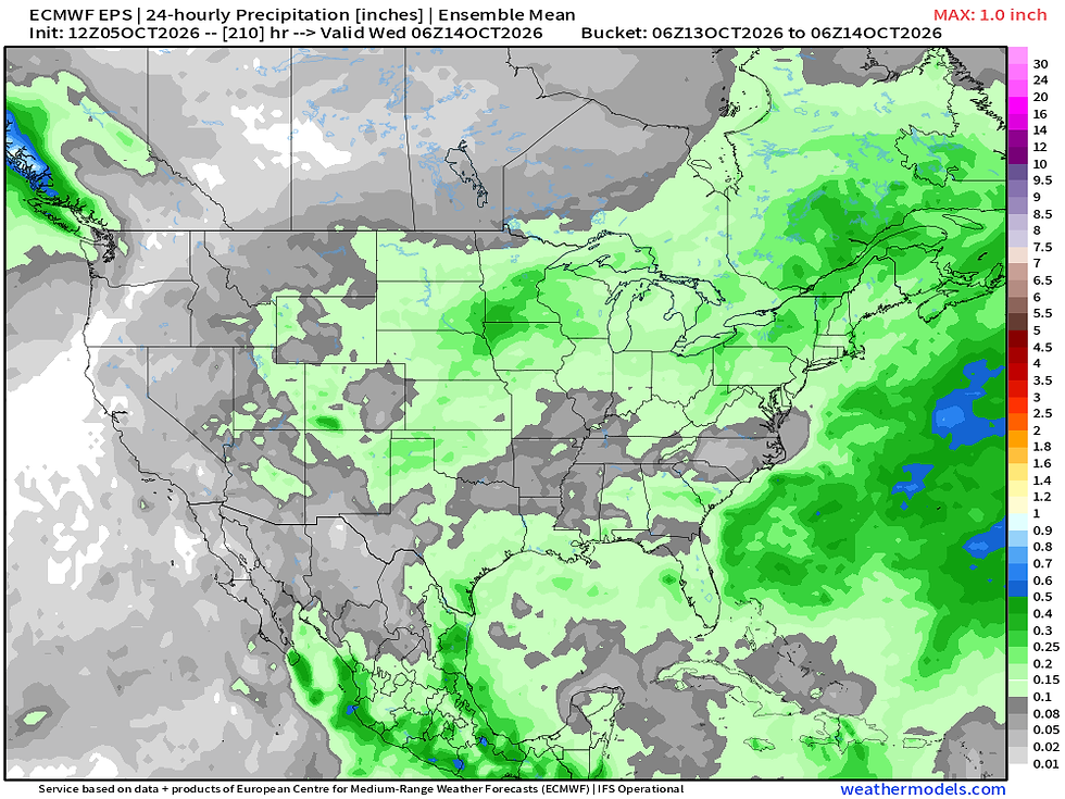
The aforementioned storm system early next week is the only thing that really grabs my attention. European Ensemble precipitation does show increasing rain chances Tuesday/Wednesday. Given the upper air support it's not out of the realm of possibility we may see a few strong storms in the region. Quite low confidence for now, but the pieces are slowly coming together.
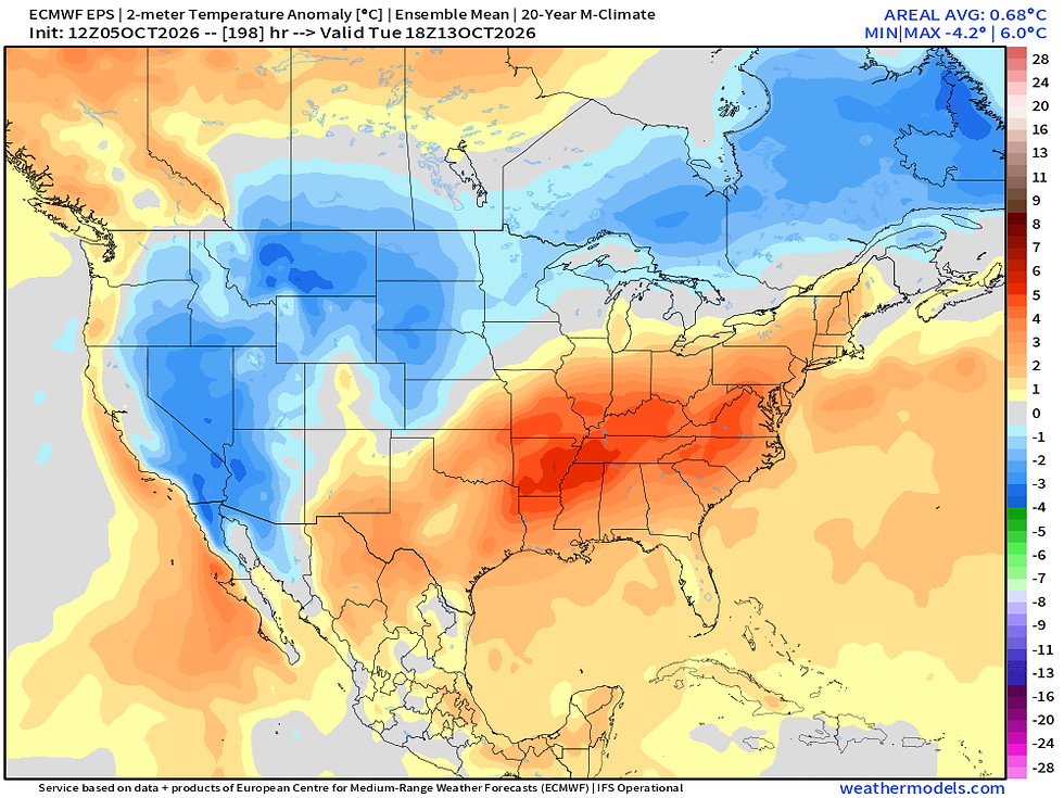
Behind that storm system we are seeing some cooler air at least more resembling the season. Temperature anomalies across the Upper Midwest are forecast to dip below/near normal, but it doesn't look like a big shot of frigid air. Not a lot of cold air has built up north yet. We should at least have some more comfortable days midweek next week. Some long-range projections put Oct. 16-18 on watch for another shot of cooler air, but really that's just too far out to get too excited.
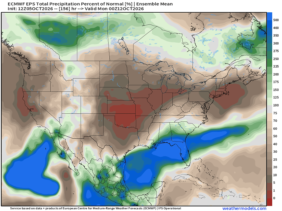
Dry weather is the main theme in the areas that could finally use some dry time with less than 1% of normal expected through next Monday. Have a great week, friends!
-Meteorologist Nick Stewart


Comments