


NOTHING COULD BE FINER...
- Apr 21
- 2 min read
I knew Tuesday had the makings of a fine day and brother, it did not disappoint. Highs of 77-81 with sunshine and low humidity is a combination that's just about imposible to beat. However, lets see if we can do it with another chamber of commerce day Wednesday. I expect a re-run of sun, dry air, a fresh breeze and highs of 79-83. Tough to turn your nose up at that.
Synoptically, changes enter the picture Thursday afternoon when a pair of short wave troughs eject out of the Plains and lift into the upper Midwest between then and Monday night.

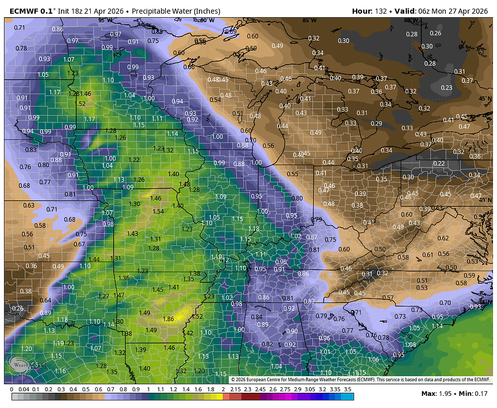
Both systems will have a decent window to draw significant moisture back into the region with water vapor associated with each peaking at 1.20 to 1.40 inches.
PWATS Thursday evening

PWATS Sunday evening.
While both systems have some good dynamics and moisture to work with, it appears that the timing or track will be such that severe weather is minimal locally. Some thunderstorms are expected, especially Thursday night but CAPE just never reaches the level for much in the way of severe weather this far east.
That said, the moisture and forcing should assemble a couple more generous rounds of rain that each could amount to 1/2 to nearly as much as an inch. Combined, up to 2 inches could end up falling in spots with most areas seeing at least an inch between the two rounds of rain Thursday night and again Sunday night and early Monday. Here's what guidance is currently suggesting for rainfall totals. More than enough to keep the grass flourishing.
The GFS

The EURO

The National Model Blend.

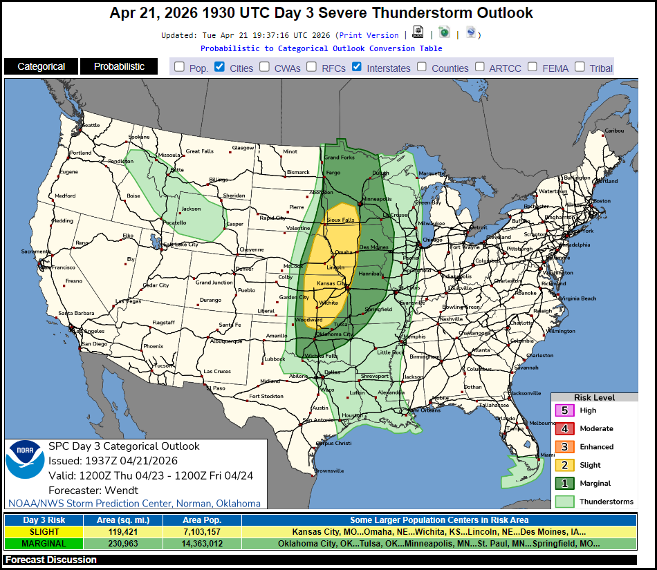
Again, SPC shows the slight severe weather risk well to the west later Thurday night.
As mentioned earlier, temperatures start out near 80 and then cool a bit as the second system passes Friday into Monday. Even so, readings readings should remain near to a bit above normal into early next week.

It's beyond next Monday when the long wave storm track settles south of our local area that we can expect periodic rain chances and a signficant amount of clouds. WInds will likely prevail out of the E/NE much of next week which is the kiss of death for mild readings. For the 7 day period April 28th through May 6th temperatures are expected to average at least 6 degrees below normal per day.

My advice, enjoy the next 2 days as after that, teleconnections strongly suggest a period of cool damp weather to close out April and start the month of May. In fact, I would not be surprised if cooler than normal temperatures prevailed into mid-May. The MJO is certainly trending in that direction.
Enjoy the sensational day and as always, roll weather....TS


Comments