


STRONG STORMs FOR SOME...
- Mar 10
- 4 min read
It's early March and it is unusual to see a significant storm threat this far north. However, that is the situation my counties from the Quad Cities southeast find themselves in. A rather robust set of parameters seems to be in play for severe thunderstorms that could produce all modes of severe weather. That includes the potential of strong tornadoes, EF2 or greater towards late afternoon or evening.
Currently, SPC has an enhanced level 3 risk of severe weather in place from SE Iowa into WC Illinois. A level 2 threat exists further to the NW into EC Iowa and northern Iowa.

The hatched yellow zone below depicts a 10-14% risk of tornado within 25 miles of a point. SPC also mentions a chance of long tracked supercells with strong tornadoes.

There is also a 30-44% risk of severe hail within 25 miles of a point in the same general area as the greatest tornado risk.

As indicated, my NW counties have a much lower chance of strong storms due to a front which will be situated in a west to east fashion along I-80. It will stratify moisture with dew points ranging form 40 in Dubuque to 69 in Burlington. The end result is a fairly stable atmosphere in the north compared to one that is extremely unstable in the south.

Enhancing storm potential is the fact highs in southeast Iowa and WC Illinois may reach the mid to upper 70s. (The record in Burlington is 75). The warmth, and such a juicy air mass south of I-80, may generate surface based CAPE (instability) well over 2,500 j/kg. Note the sharp cut-off to the surface based instability near I-80.
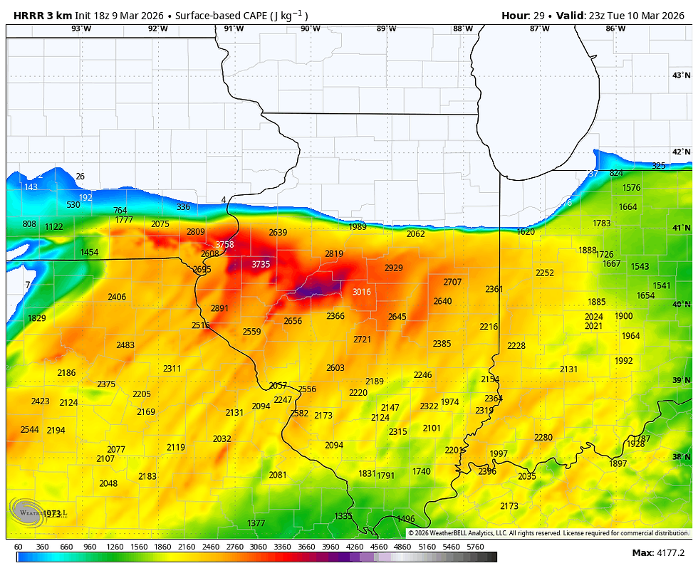
With ample low level moisture and steep lapse rates, a well organized convective environment is likely to develop near and just south of the warm front. Substantial low level shear will support the potential for tornadoes, including strong tornadoes "if" any discrete cells can root on the boundary.
Even north of the boundary, any elevated storms that develop will still be in an environment that could produce very large hail with a much lower tornado threat. As the evening hours unfold, storms should also grow upscale into clusters or broken lines supporting a strong wind threat. How soon that happens is uncertain, but it would quickly shut down any tornado concerns. Right now the tornado potential seems greatest between 5:00 and 9:00 pm. in the south and east.
There are a couple of conditional concerns regarding the extent of severe weather. One is a CAP (warm air aloft) that might limit storm initiation until early evening, just before sunset. The EML could limit the time storms have to produce tornadoes, or thwart them entirely (I would not count on that just yet).
The other concern is the placement and orientation of the near stationary boundary, and the potential influence a cool lake breeze off Lake Michigan could produce. That needs to be watched as it could temper the ability of updrafts to become surface based supercells. Needless to say, severe weather outbreaks are difficult to get precise with much in advance. There are so many details that are unknown until a few hours before storm initiation that can make or break the threat (a couple I mentioned above). That said, compared to many set-ups this event has some concerning signs and I would pay close attention to forecasts and any watches that end up being issued, especially from the Quad Cities southeast.
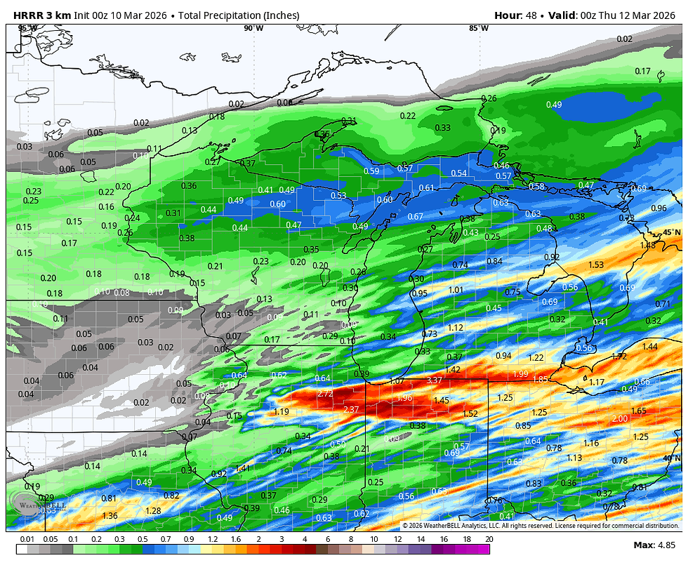
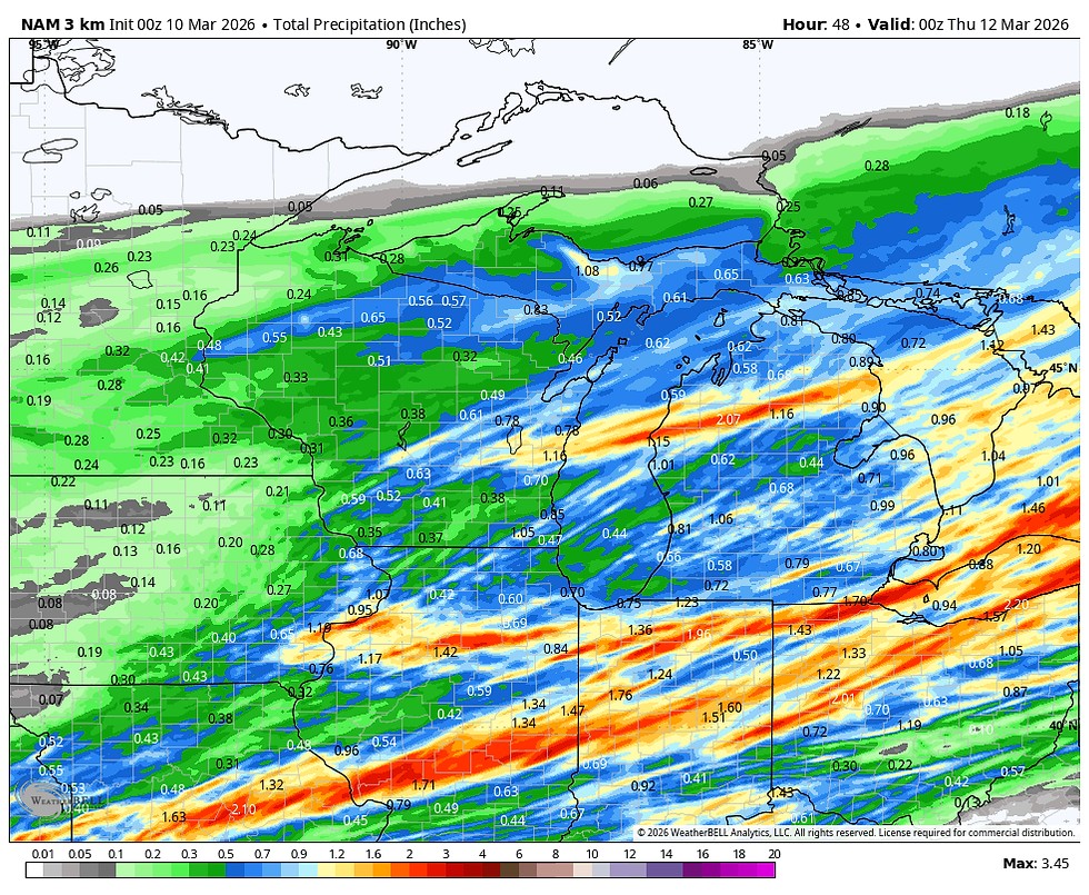
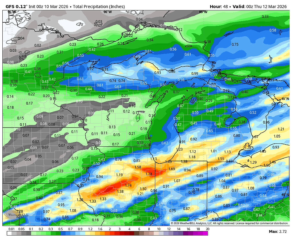
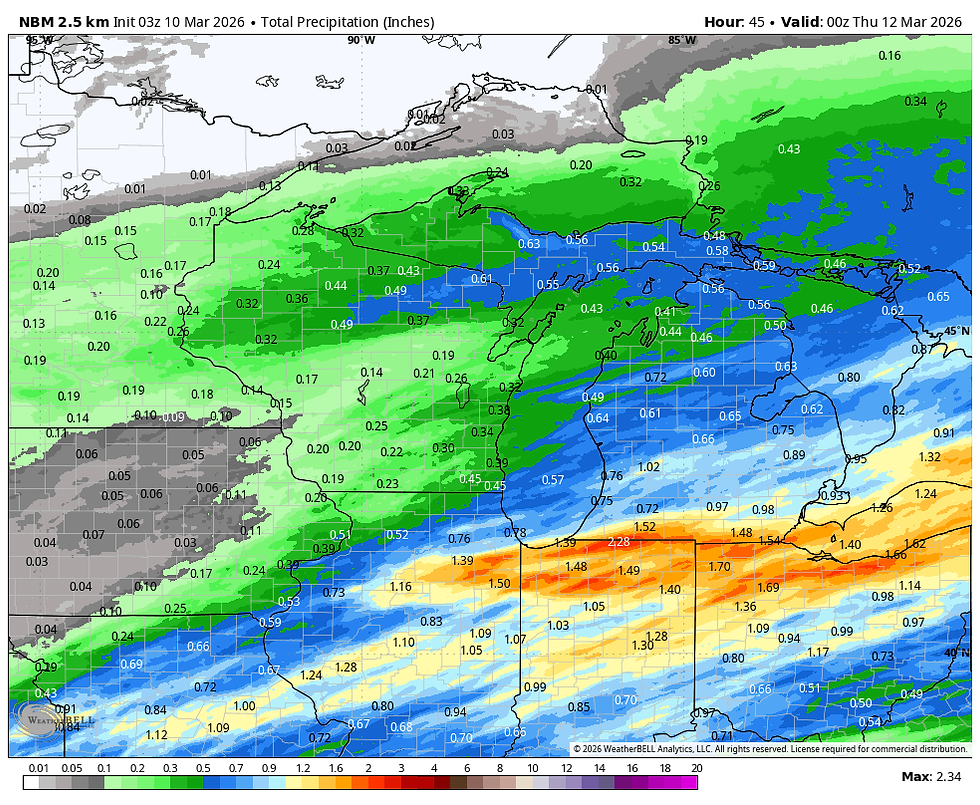
One bit of good news, is that beneficial rain again falls in parts of the area. Some of the stronger storms could easily drop well more than an inch. Here's what models are currently suggesting for rainfall.
The HRRR
The 3K NAM
The EURO

The GFS
The national blend of models
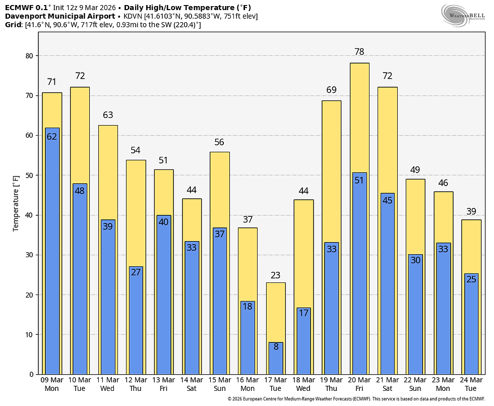
I should also point out that following this event, temperatures are going to start trending downward. It's gradual at first, but by mid-March a couple of pretty fresh days are possible. The EURO shows this the next 2 weeks.
Also, about the time that really chilly air shows up, the ensembles of both the EURO and GFS are indicating some snow potential. Here's what the ensemble means of the EURO and GFS are showing. I would say this is still low confidence and far from certain.
The EURO ensembles (51 members)

The GFS ensembles

One day at a time is the way I'm playing it for now. Keep and eye to the sky later today, particularly if you are anywhere near or south of I-80. Roll weather...TS
PS. I'm happy to say that I reached my financial fundraising goal. My sincere thank you to all of you who made contributions and have taken it upon yourself to support the site. You are stuck with TSwails for awhile. If you haven't contributed, and think the site has value, or you use it extensively, it is still possible to donate. Any contributions will go into a trust to be used to support the site going forward. Thanks again!


Comments