


STUCK IN THE CLOUDS...
- Dec 22, 2024
- 1 min read
While we're getting a break from the bitter cold, it may not always feel pleasant outside. Clouds are going to be one of the constants this week. A strong, large ridge (high pressure) will be taking over in the upper levels:

Despite different systems coming through, and the clouds, temperatures will be above normal. Here's a look at the Quad Cities temperature trend through Saturday:

Temperatures each day will be above normal and above freezing. There will be a clipper moving through early Monday morning, which could lead to some rain/freezing drizzle:
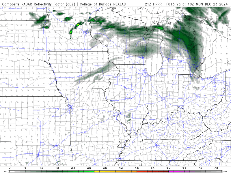
There may be a few patchy slick spots in the morning. Otherwise it will be a cloudy day with temperatures in the mid to upper 30s. Clouds stick around Tuesday and Wednesday with temperatures in the mid to upper 30s. Here are the Christmas Day temperatures:

Thursday will be mild ahead of an approaching warm front, which will lead to some rain showers into Friday morning:

Friday will be the warmest day of the week with temperatures running 10-15 degrees above normal:

More rain will be possible here and there Friday into early Saturday as that system lifts north:

Colder air will likely move in as we head into the new year. You can see the change in the upper level pattern to a big 'ol trough in early January:

Enjoy the little break from winter while it lasts!
Rebecca Kopelman


Comments